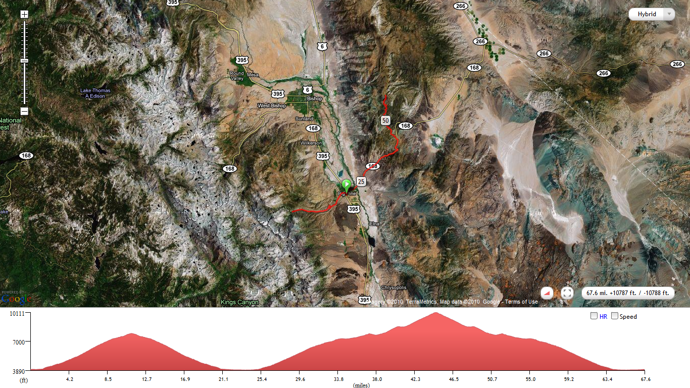
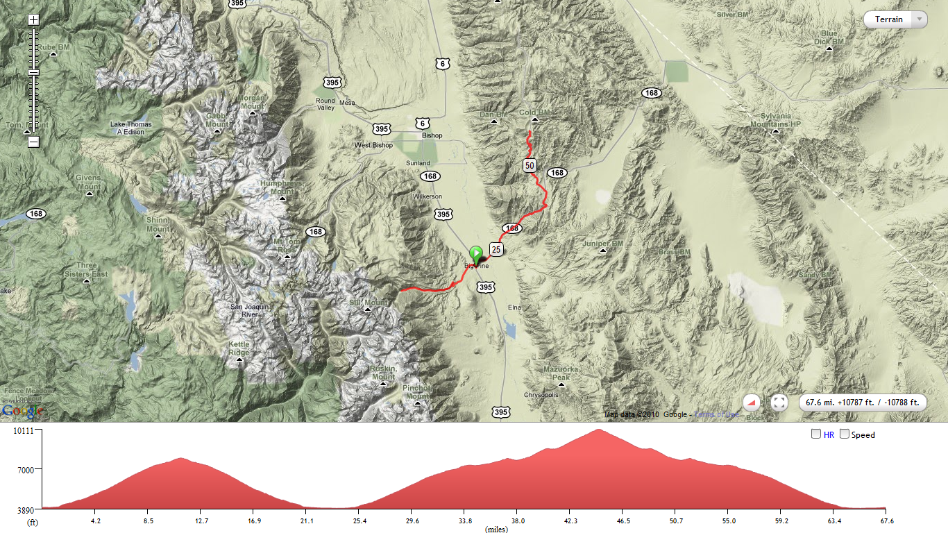
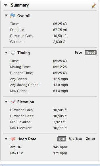
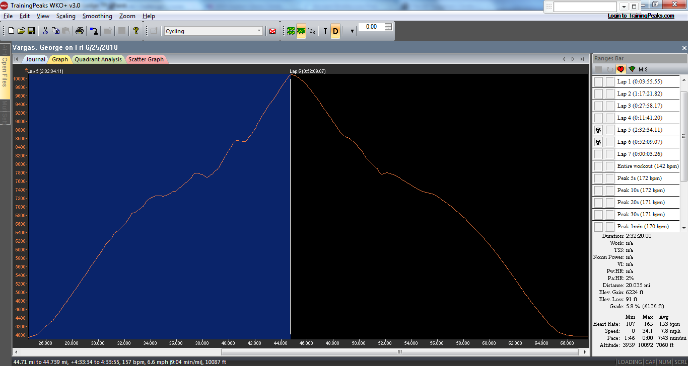
10,000 feet of gain in just 44 miles!!

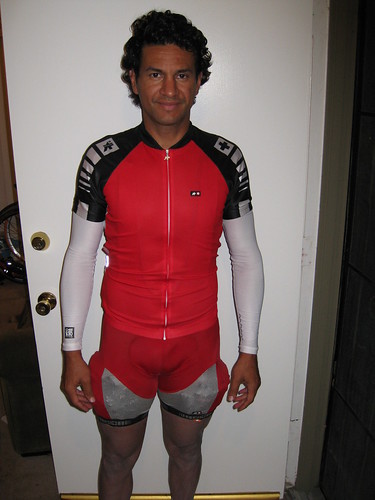
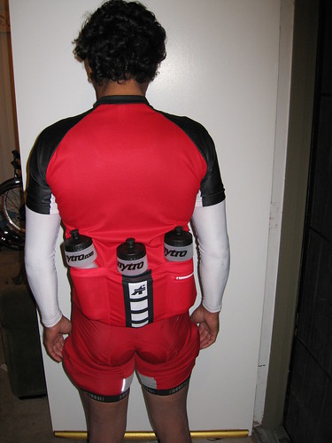
I haven’t decided whether I will be “racing” Everest Challenge this year. It is only one week before my goal event, the Furnace Creek 508. But since I was spending the night in Lone Pine I thought I might as well make the short 40 mile drive up to Big Pine and do some more climbing. Yesterday I climbed Shirley Meadows and Sherman Pass which were the only two climbs I hadn’t done on the Top 10 Toughest Climbs in California.
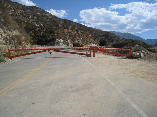
Today’s climbs were Glacier Lodge and Ancient Bristlecone. They are climb #1 and Climb #3 on the second day of Everest Challenge. I skipped Climb #2 Death Valley Road for two reasons:
1. it isn’t that exciting to me
2. I was riding solo and didn’t want to double back one extra time to refuel.
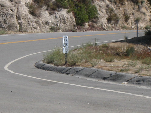
GLACIER LODGE
10 miles 4,000 feet of gain
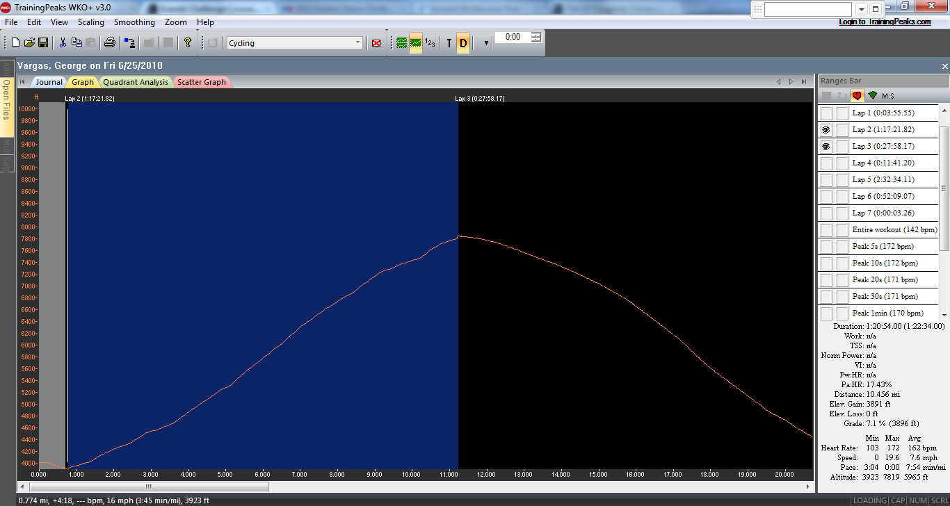
I parked at the base of the Glacier Lodge climb. I rode up the 10 + mile climb, warming up along the way. The grades were as steep as I remembered them nothing had changed. 😦 I rode the climb at tempo and felt strong at times and not so strong at other times. I think if this climb was another mile or two in length it might make the Top 10 list for California. As such it is only 9 miles of hard climbing. 😉

Glacier Lodge Climb

4,000 feet of gain in 10 miles!

Glacier Lodge percent of grade graph

Glacier Lodge Climb data from Garmin Training Center
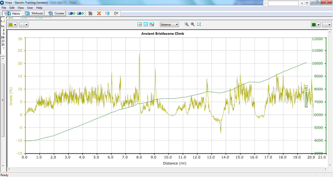
ANCIENT BRISTLECONE
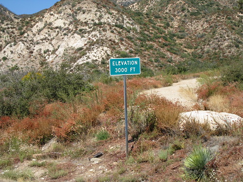
6,243 feet of gain in 20 miles
Max elevation 10,100 feet
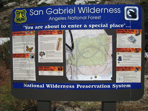
Next up was a monster climb called Ancient Bristlecone, also known as White Mountain. The climb gets its dual name from one the oldest trees and also because you turn off of Hwy 168 to complete the climb on White Mountain Road. The climb is on the Top 10 toughest climbs list generated by John Summerson.

This tree is located on the east side of Patriarch Grove at 11,200 ft. of elevation, is one of the most picturesque of all bristlecones in the White Mts.
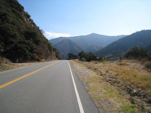
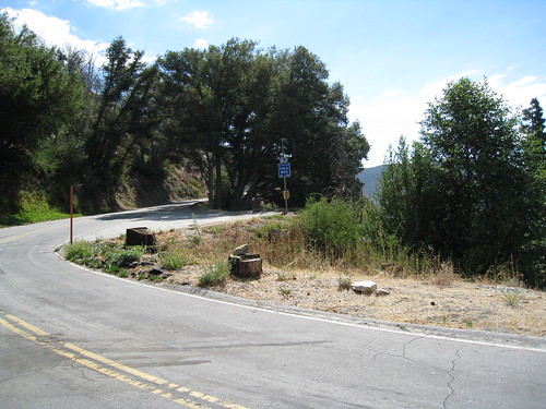
Ancient Bristlecone/White Mountain Road is one long-ass climb. The bottom half ramps up continuously with 12% rollers. You think you are tired or don’t have the legs because the terrain belies the actual steep grades you are struggling to overcome. The lower portion of the climb is just something you have to get through to get to the good part. Once the road starts to narrow that’s when the climb gets scenic and seems to be worth all the suffering on the desert-like scapes of the lower slopes.
The upper half is lined with trees and rock formations and even single lane sections. It’s really a lot more appealing to the eye when you get to the tree line. Once off the 168 onto White Mountain Rd you really feel like you are in an alpine climb in another country. It’s one of my favorite sections of the climb. The steep rollers are not all done yet. I remember distinctly at the 8,000 foot elevation sign a good steep roller waking me up from my lull. As you continue to ascend, you need to ready yourself for the last three miles which will be at 10% average. So make sure you save some for the last few miles of the climb because it WILL get steeper and remain consistent to the end–when you are most tired.
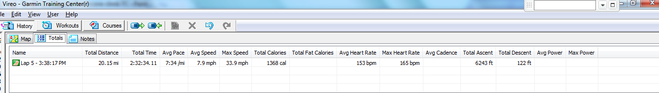
As I crested, it was drizzling and getting cold. When I started the climb in Big Pine, just 2.5 hours earlier and 6000 feet lower, it was 95 degrees F now I was shivering from the cold and getting wet as well. I wasn’t going to be hanging out at over 10,000 feet of elevation with what looked like a storm coming in. I wanted to find a marker, an elevation sign or anything to document my ascent but I was in a hurry to get down from elevation and OFF THE MOUNTAIN. I immediately turned around and started my recovery process while I was descending. I felt I had done a good day’s work of over 10,000 FEET OF GAIN IN JUST 44 MILES.
As a refresher, or if this is your first time reading my blog the list below created by John Summerson is what I have been working to complete in my last two “weekends”.
Most Difficult Climbs:
1) Onion Valley — DONE 6/10/10 !!
2) Horseshoe Meadows — DONE 6/10/10!!
3) White Mountain– DONE 06/25/10!!
4) Sherman Pass– DONE 6/24/10!!
5) Whitney Portal — DONE 6/10/10!!
6) Mount Baldy– DONE- too many times to mention
7) Shirley Meadows– DONE 6/24/10!!
8) South Lake– DONE as part of Everest Challenge Stage Race
9) Mount Palomar– DONE 6/06/10!!– too many times to mention
10) Mosquito Flat– DONE as part of Everest Challenge Stage Race
Greatest Elevation Gained:
1) Horseshoe Meadows – 6,234 feet– DONE 6/10/10 !!
2) White Mountain – 6,204 feet DONE 06/25/10!!
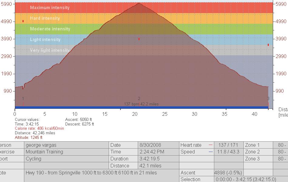
3) 190 – 6,199 feet
4) J21/245/180 – 5,750 feet
5) Mosquito Flat – 5,548 feet- DONE AS PART OF EVEREST CHALLENGE
6) Dantes View – 5,475 feet
7) South Lake – 5,445 feet- DONE AS PART OF EVEREST CHALLENGE
 Sherman Pass – 5,316 feet– DONE 6/24/10!!
9) Emigrant Pass – 5,309 feet– DONE 04/04/10 – BLOG POST
10) Onion Valley – 5,169 feet DONE 6/10/10!!
Highest Elevation Attained:
1) Mosquito Flat – 10,220 feet- DONE AS PART OF EVEREST CHALLENGE
2) White Mountain – 10,152 feet DONE 06/25/10!!
3) Horseshoe Meadows – 10,034 feet DONE 6/10/10!!
4) Tioga Pass – 9,945 feet
5) South Lake – 9,852 feet– DONE AS PART OF EVEREST CHALLENGE!
6) Sonora Pass – 9,624 feet
7) Kaiser Pass – 9,184 feet
Onion Valley – 9,163 feet — DONE 6/10/10!!
9) Lake Sabrina – 9,141 feet
10) Sherman Pass – 9,126 feet– DONE 6/24/10!!

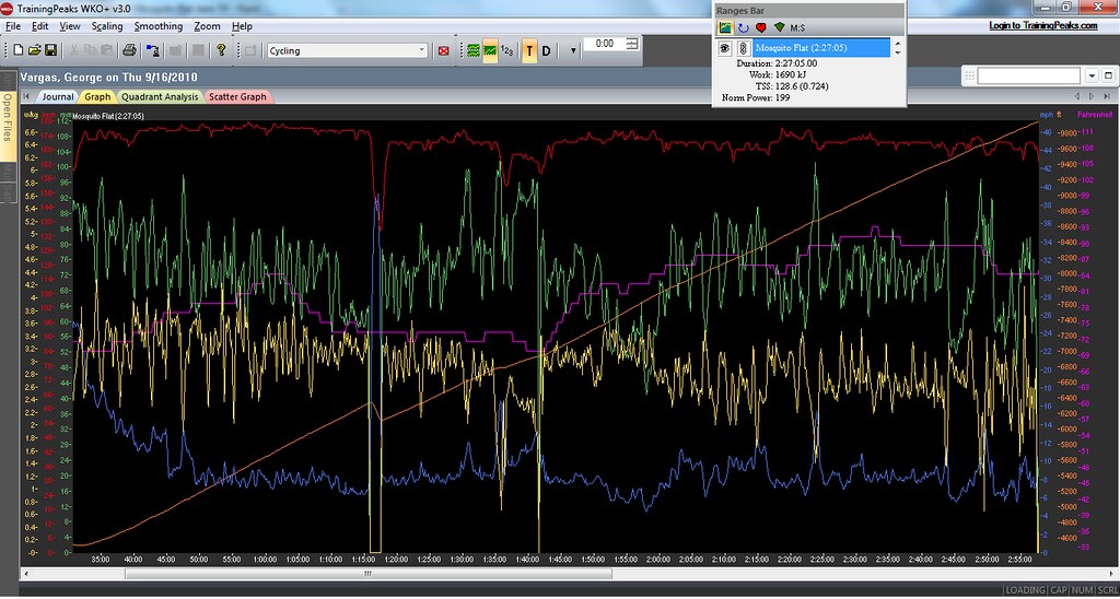
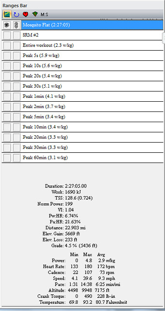
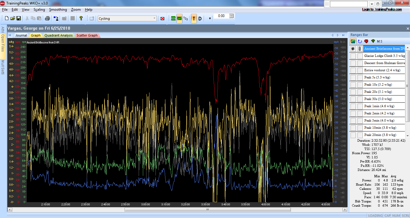
Ancient Bristlecone Climb power data


Ancient Bristlecone Grade Analysis from Garmin Training Center

Ancient Bristlecone AKA White Mountain data from Garmin Training Center
All for now. Thank you for reading my blog. Pass it on to a good friend. See you on the road.
UPDATE HERE ARE GARMIN FILES FOR THE 2010 EVEREST CHALLENGE
DAY 1
DAY 2