Hell’s Gate Hundred- Done!


Wow what an awesome ride.  The Hell’s Gate Hundred exceeded my expectations!  100 miles with 8.500 feet of climbing!  Artist Drive was a pleasant surprise.  I didn’t know that loop existed and it was very cool.  The Hell’s Gate climb that went on and on to Daylight Pass– 16 miles about 4500 feet of gain– niiice!!

I’m very happy with my performance.  I had a couple of issues early on but then had a great ride afterwards.

 I’ll post more later but I just wanted to drop a quick post.

What’s next for the Red Eyed Vireo?


I’m trying to decide if I should do the Hell’s Gate Hundred ,an event put on by AdventureCorps, on April 3.  I love doing their events because:

1. they are in Death Valley and
2. they are professionally run from the race director to the volunteers.

What’s holding me back?  Well I’m already doing the Mount Laguna Bicycle Classic on April 17th (my pre-ride here) and I’m supposed to work weekends- or at least one of the two days.

Here is the graph looks challenging and fast.  I’m 100% in but what will work say?  Stay tuned….

80 for Haiti


Quick post — just got back from volunteering for the 80 for Haiti fundraising ride.  The riders were blessed with perfect weather for riding.  Beautiful blue skies with not a cloud in the sky.  AdventureCORPS did it again.  They had a perfectly organized and supported event.  The numbers were about 150 riders.  That is amazing considering the short amount of time AdventureCORPS had to put the ride together and keep in mind the Tour of Palm Springs was being held on the same day.  The Tour of Palm Springs attracts about 5,000 riders.

Let’s keep in mind why we the ride was put on.  Click here for special CNN coverage of the earthquake in Haiti
From the ride director:

A total of 157 cyclists from across California (and beyond) are coming together to ride the event, having paid $13,400 in entry fees (donations from $80 to $250 each), plus 97 non-riding supporters have donated $10,373, totaling at least $23,773 to support MercyCorps’ efforts in Haiti. This is the only known cycling event in the USA which was created in response to the crisis in Haiti and is likely one of the only fundraisers of any kind which is donating 100% of the proceeds (not just “the profit”) to support Haiti relief efforts. Thank you for playing an important role in this effort!


80 for Haiti


FOR IMMEDIATE RELEASE: 80 FOR HAITI BENEFIT CYCLING EVENT (FEB 13, NOT FEB 6)


L’Union Fait la Force / Strength Through Unity = National Motto of Haiti
LA JOLLA, CA –  AdventureCORPS, Inc., an athlete-run firm producing some of the world’s toughest sports events – including the Badwater Ultramarathon and Furnace Creek 508 races in Death Valley – will host “80 FOR HAITI,” a cycling benefit ride for Haiti relief supporting Mercy Corps on Saturday, February 13, 2010.  The event will feature an 80-mile ride along Old Hwy 80 in southeastern San Diego County. There will be an $80 entry fee and 100% of the entry fees will go directly to Mercy Corps, one of the most respected relief organizations worldwide. AdventureCORPS will absorb all costs, but food, drink, and support sponsors are being sought.
The “80 FOR HAITI” cycling event start / finish line is just 44 miles east of San Diego, in Pine Valley, CA. The route is spectacular, on absolutely quiet roads through rolling terrain.
As international relief efforts continue in Haiti, a Mercy Corps earthquake response team is in Port-au-Prince responding to urgent needs.
Registering for this ride – or donating to the cause, if you can’t do the actual ride – will help families in Haiti recover from the most powerful quake to hit the country in more than 200 years. Mercy Corps relief workers with experience in disaster responses ranging from Hurricane Katrina to the Myanmar cyclone are converging on Haiti from Africa, Asia, and North America. They’re focusing first on the immediate needs — for water, food, temporary shelter supplies and much more — and expanding their work to three areas: clean water, post-trauma support for children, and job creation.
The needs in Haiti are immense. Its capital lies in ruins, as many as 200,000 may be dead, and survivors are increasingly desperate for food, clean water and shelter. Please ride “80 For Haiti” and/or give what you can to help families recover.
Cycling participants in 80 FOR HAITI must pre-register for the event, so that we can plan accordingly. PLEASE register prior to February 8 for the ride. Donations will be accepted through February 13, and beyond.

Can you ride 80 miles for Haiti? | Can you donate $80 (or more) for Haiti, whether you ride or not? | Can you help us spread the word about this event – RIGHT NOW? Please do!


Click here for all the 80 FOR HAITI information and the Link to Registration / Donation:

Don’t Want to, or Can’t, Ride 80 FOR HAITI, but you still want to donate? Or perhaps you and your friends want to ride your own “80 FOR HAITI” near where you live? Go for it! Please use this link and DONATE NOW directly to Mercy Corps:
80 FOR HAITI HIGHLIGHTS:
• February 13, 2010
• Held along Eastern San Diego County’s Old Hwy 80: Minimal traffic, no traffic lights, and just a few stop signs.
• Three well-stocked checkpoints, plus roving SAG support vehicles on the course.
• The entry fee is a minimum $80 donation: 100% of ALL entry fees will go to Mercy Corps.

ABOUT THE HAITI EARTHQUAKE
The 2010 Haiti earthquake was a catastrophic magnitude 7.0 Mw earthquake with the epicenter near Léogane, approximately 25 kilometres (16 mi) west of Port-au-Prince, the capital of Haiti, striking at 16:53:10 local time (21:53:10 UTC) on Tuesday, 12 January 2010. The earthquake occurred at a depth of 13 kilometres (8.1 mi). The United States Geological Survey recorded a series of at least 33 aftershocks, fourteen of them between magnitudes 5.0 and 5.9. The International Red Cross estimated that about three million people were affected by the quake, and the Haitian Interior Minister believes that up to 200,000 have died as a result of the disaster, exceeding earlier Red Cross estimates of 45,000–50,000. Several prominent public figures are among the dead. The Haitian Prime Minister Jean-Max Bellerive recently announced that over 70,000 bodies have been buried in mass graves. Source (and more details): Wikipedia.com

OFFICIAL CHARITY
The Official Charity of 80 FOR HAITI is Mercy Corps. Mercy Corps is a team of 3700 professionals helping turn crisis into opportunity for millions around the world. By trade, they are engineers, financial analysts, drivers, community organizers, project managers, public health experts, administrators, social entrepreneurs and logisticians. In spirit, they are activists, optimists, innovators and proud partners of the people they serve. According to their website:

“Mercy Corps has long been recognized as an excellent steward of the resources entrusted to it. Over the past five years, more than 89 percent of our resources have been allocated to programs that help people in need. Ensuring that resources are wisely spent is the cornerstone of our values, vision, and strategy for growth in the future. We are proud of the awards, endorsements, memberships, and honors that substantiate our track record of accountability.”

More info about Mercy Corps’ Efforts in Haiti: http://www.mercycorps.org/haiti

Mount Laguna Bicycle Classic Pre-Ride


Wow what a fantastic day Brandy and I had on yesterday’s Mount Laguna Bicycle Classic Pre-Ride

                             
From the AdventureCorps website:
The 2010 Mount Laguna Bicycle Classic is the newest AdventureCORPS cycling event, featuring 103 miles with 10,000 feet of climbing and three different ascents of San Diego County’s Mount Laguna! We’ll climb San Diego’s highest point via Sunrise Hwy from the north, via the fabled and car-free Kitchen Creek from the south-east, and via the little-known and truly epic Pine Creek drainage from the west. There are just three stop signs and NO traffic lights on this incredible route which starts and finishes in Pine Valley, CA!
This is a tough climbing century– the way they all should be.  The weather in the mountains, in November, takes special planning.  We were blessed with fantastic weather.  We had clear skies, and barely any wind.  Sure it was cold (low of 35F at the start) but it was to be expected.  We dressed in many layers consisting primarily of  wool and then synthetics for our wind shells. The weather in April will be warmer than what we had to contend with yesterday but you should plan accordingly — it is the mountains after all. 

 Here is a link to yesterday’s weather in Pine Valley.

 Pine Valley County Park is located at 3736 feet elevation.   

Click here for Pine Valley weather from the National Weather Service

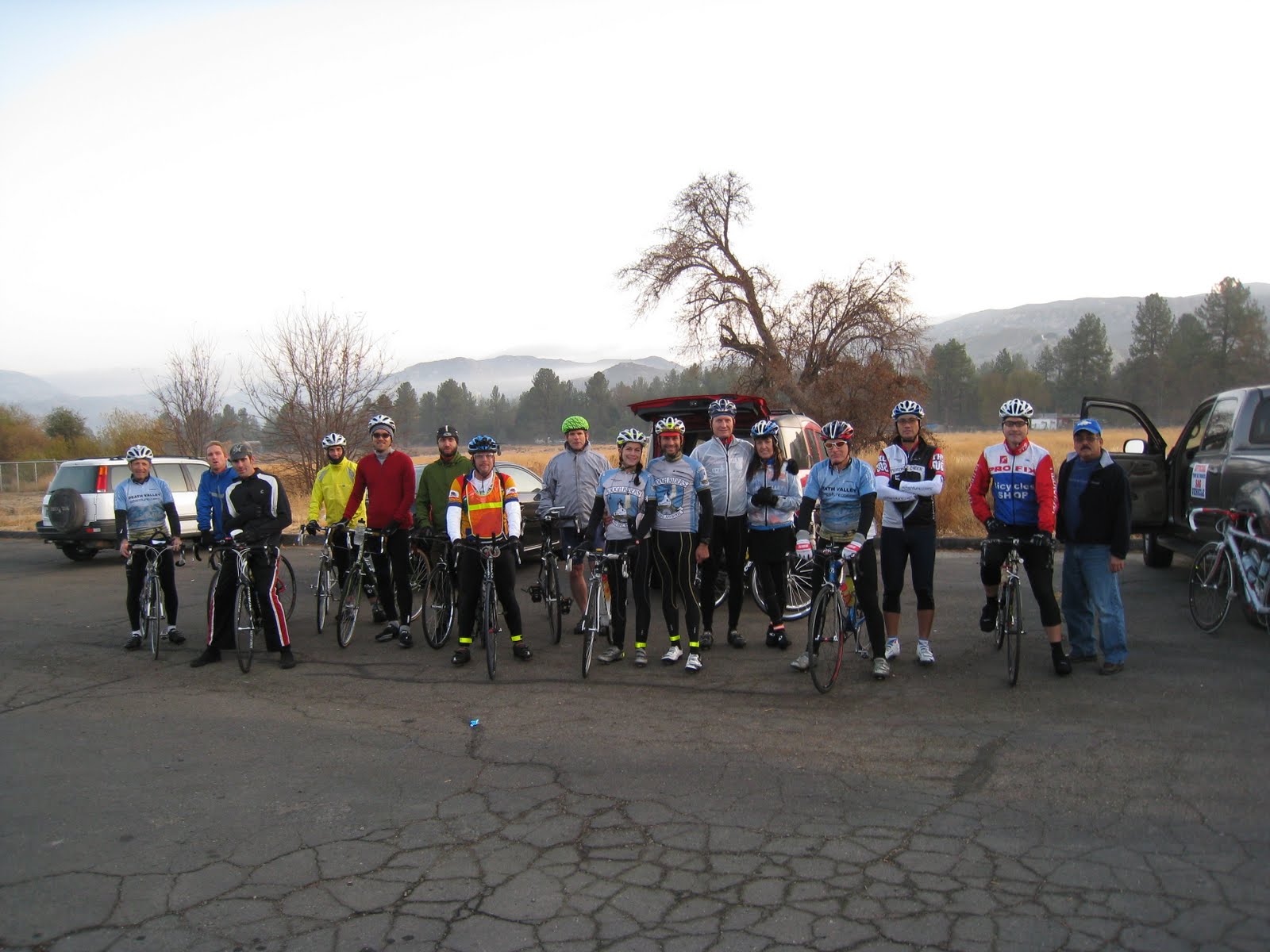
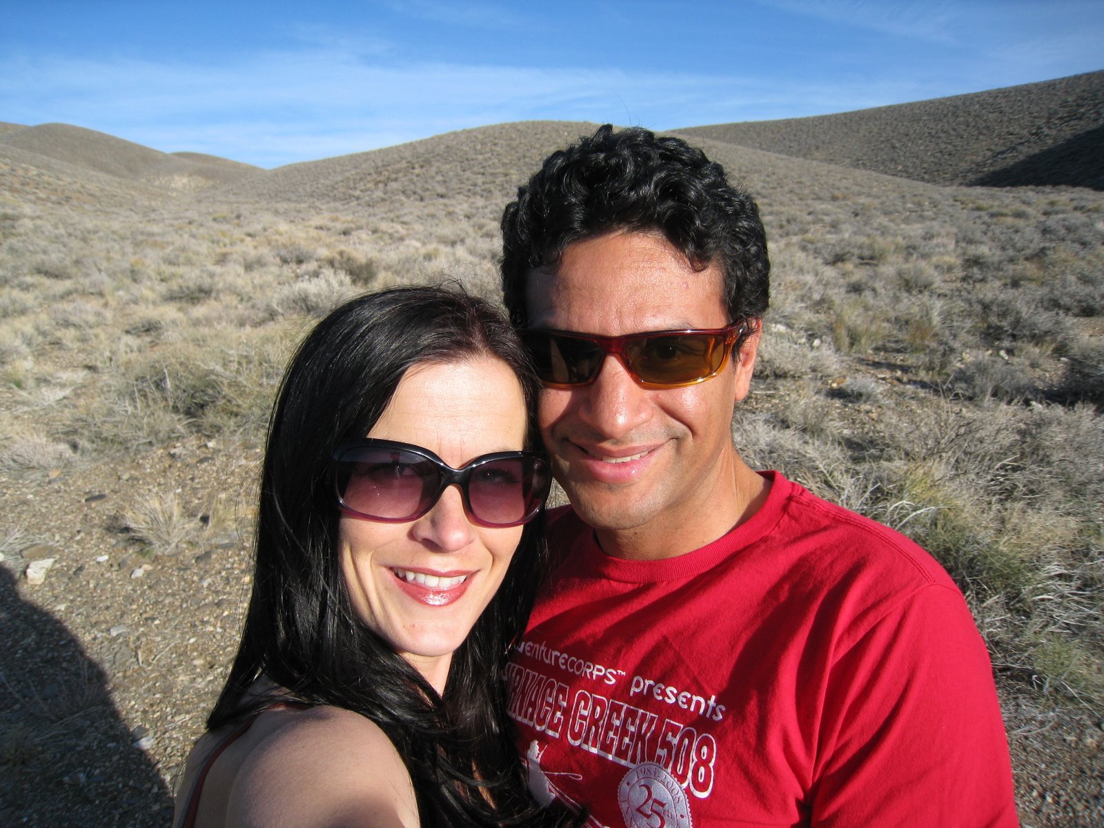
Fifteen riders began at 630am and one later on.   We had riders of different levels but there seemed be quite a few Furnace Creek 508 veterans.  A ride like this gives us an opportunity to get to know each other since the 508 is essentially a 500 mile time trial — drafting or riding alongside another racer is prohibited.  We also had a special guest the godfather of Ultra Cycling John Marino.  Complete list below:
Jack Blackbird Bochsler

John Byrne (mtn biker who arrived late)
Brian Emperor Moth Davidson (Team Swarm!)
Brandy DeLuca (Team Sho-Air)
Joe Gargoyle Garza
Francis Picachu Ignacio (Adobo Velo)
Elizabeth Jefferson (AdventureCORPS Rough Riders)
Chris Kostman (AdventureCORPS Rough Riders)
Jack Jaxartasaurus Lindquist (Team Swarm!)
John Marino
Scott Palka
Matt Desert Locust Ruscigno (Team Swarm!)
Dustin Sharp
Greg Great Dane Sherman
George Red-Eyed Vireo Vargas (Team Sho- Air)
Roy Wallack

The first loop from the AdventureCorps website:
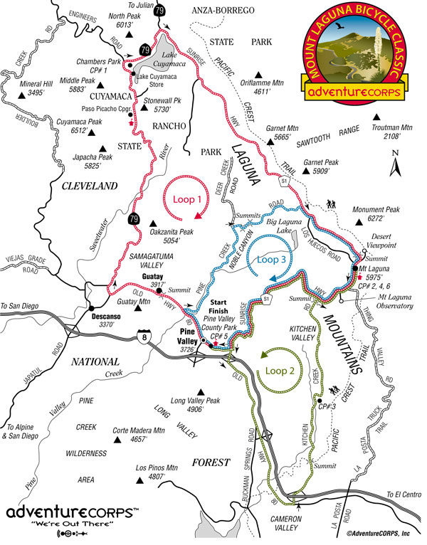
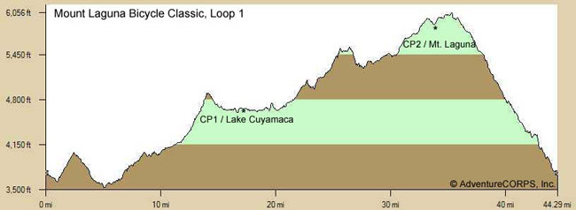
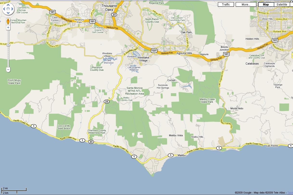
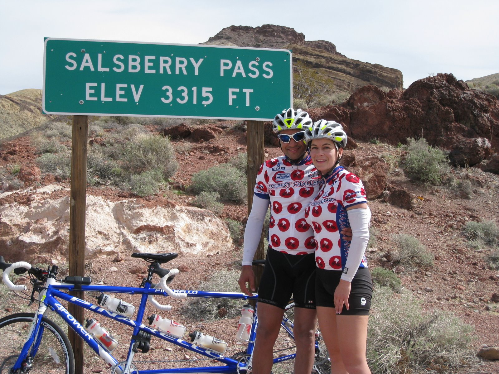
Loop One is a clockwise route from Pine Valley to Guatay, north on 79, around Lake Cuyamaca, and south on Sunrise Hwy over Mt. Laguna. (It does not quite return to Pine Valley.) Distance: 43.4 miles; Elevation Gain: 3770 feet.
A short descent from the Pine Valley start, a short climb to Guatay and then another quick descent.  We then climbed for next 30 miles.  Lots of up and down as we gradually made the ascent from 3600 feet to 6000 feet.  The views were spectacular throughout the ride.  In particular, I’ve always enjoyed going around Lake Cuyamaca and seeing the meadow off to the right with the mountains as a backdrop.  Race Director Chris Kostman promises an even better view in the spring with flowers in the meadow. 
Basic data–
Checkpoint #1  approx 17 miles and 1940 feet of climbing
Checkpoint #2  approx 16 miles from CP#1 to CP #2 and another 1770 feet of gain (34 miles 3710 of gain)
A note of caution– the road to Lake Cuyamaca is narrow.  It does widen later but there is a short stretch where you must stay as far to the right as possible.  We had little traffic, considering it was before 7am. Riders should expect a few kickers here and there that ramp up over 8% just to keep things interesting. There was also a few switchbacks as well.  There was also a few switchbacks as well.  The Race Director knowingly made this the first loop anticipating higher traffic in the spring.  The ascent on Mount Laguna from the north heading south is my favorite and most scenic way to climb up and over the Mount Laguna summit of 6000 feet on Sunrise Hwy. The traffic is significantly less from this direction than coming from the south where there is freeway access (Interstate 8).

Here are a great couple of shots taken of us going around the lake.

 
Next we had a long descent down Sunrise Hwy towards Old Hwy 80.  The descent on Sunrise Hwy is long because you never really get up to high speeds and it requires a little work to keep the speed above 30 mph.  I have been climbing so much in the San Gabriel Mountains that I had forgotten that the San Diego mountains have cattle guards.  Here’s a tip for you– most of the cattle guards have a straight strip welded perpendicular to the others.  When I cross cattle guards I line myself up on that strip which is just wide enough for a bike tire.  In addition, I have a very loose grip on the handlebars.  The combination of those two things makes for almost no shock at all as I cross cattle guards.  You will master this technique as you descend Sunrise Hwy on three separate occasions. 
We continued to descend past the right turn for Pine Valley across I-8 and onto Old Hwy 80.  The shoulder on Old Hwy 80 is a little tore up so be careful.  You can easily attain 40mph on some of these sections.  We passed a Border Patrol checkpoint along the way– wave as you go by it must be boring work. 
TIP:  If you need something from your car this would be the time to detour from the route and get it.  It will be a couple of hours before you return.
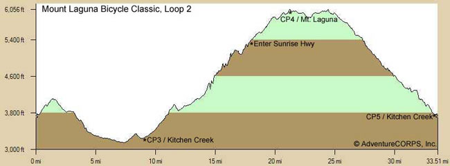
Loop Two, depicted in the following three images, is a counter-clockwise route from Sunrise Hwy east on Old Hwy 80, north on Kitchen Creek (which is closed to cars for 3.7 miles in the middle), north on Sunrise Hwy to the Mt. Laguna summit, then south on Sunrise Hwy and back to Pine Valley. Distance: 33.6 miles; Elevation Gain: 3300 feet.
At the base of Kitchen Creek we were treated to an awesome SAG stop by Adobo Velo.  These guys do it right!  Ricky and Mandy had been roving SAG during the day.  At the base of Kitchen Creek, they set-up a table with water, Hammer products and even hand sanitizer.  Also on the menu: figs, nacho chips, bananas, PB & J and so on.  THANK YOU ADOBO VELO!! 

If you don’t know the Kitchen Creek climb it’s a remote climb with a closed gated section to motor vehicles.  It is a great climb with a few steep rollers before reaching the heart of it.  
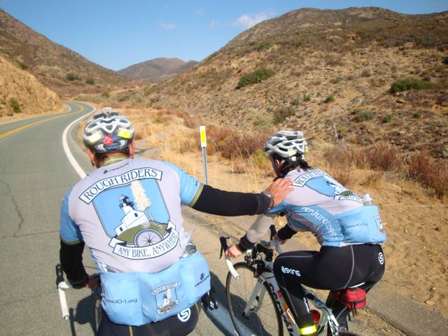
Here is a shot of me teasing Brandy that I could push her if she wanted.  No actually I’m just giving her props for doing well.
We climbed and climbed until we made the junction with Sunrise Hwy.  A right turn and we finished the climb up to the Visitor’s Center again.  We reached the Visitor’s Center at 1250.
Kitchen Creek is by far one of my favorite climbs in all San Diego County.  I love the closed gated section.  It makes it so much safer and peaceful.  If you haven’t been on this climb before then just being able to discover this climb might make the event worth it for you.  As mentioned before this is a remote climb and usually there isn’t any where to get provisions.    So having the support and knowing other riders will be coming your way will put you at ease when doing this climb during the event.  I noticed on the event website that the Race Director recommends you bring flat repair AND a complete tire.  It is great advice to heed.
Second summit on Mount Laguna approx 65 miles and 7200 feet of gain.
We descended Sunrise Hwy back to Pine Valley and restocked before beginning the third and final loop.  I can’t believe out of all the times I rode to and from Pine Valley that had I never made the turn onto Pine Creek Rd.  The third loop is the shortest but the toughest of the three.  I like the fact that it comes last in the event as a way to really test your resolve! 
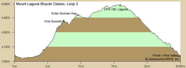
Loop Three, depicted in the following three images, is a clockwise route from Pine Valley, west on Old Hwy 80, then up the one-of-a-kind Pine Creek Road (as featured in the event logo) all the way to Sunrise Hwy, then south over Mt. Laguna and back to Pine Valley. Distance: 25.7 miles; Elevation Gain: 2820 feet (2000 feet of which is gained in the 10.2 miles on Pine Creek Road).
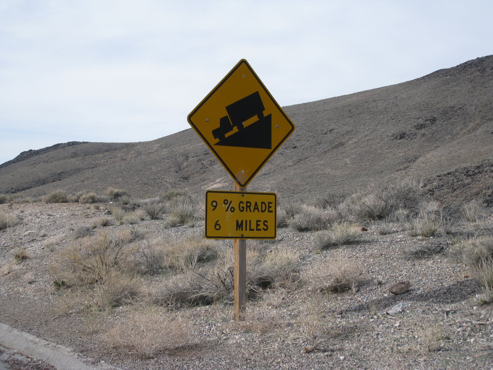
Notice the sharp ramp up beginning on Mile 4.  There are significant pitches of over 18%.  Be assured this will be the climb that separates the “pretenders from the contenders” as they say.  I would strongly suggest compact gearing. 
What is COMPACT GEARING you ask?  Cranksets typically come in “standard” set up of 53/39.  In other words, your big chainring is 53 teeth and your inner or small chainring is 39 teeth.  A compact crankset has typically a 50/34 for chainrings.  It allows for easier climbing in your 34 front chainring and whatever large cog you can muster for the back.  Don’t be ashamed to use a triple chainring on this course either.  By the way, the term compact does not have any relation with crank arm length just the chainrings.
Brandy and I had to really work on keeping the pedals turning.  I had a standard 53/39 and 12/27 cassette.  I consider myself a good steep grade climber.  By that I mean, that when the road really pitches up I can ascend them better than the next guy or gal.  On long climbs of 6% grades I don’t fair as well.  Brandy had a compact crankset and a 12/27 cassette.  She really suffered on the Pine Creek Rd. 
Let’s set aside the difficulty of the climb for a moment and focus on why we climb mountains.  The views from Pine Creek Rd. are simply amazing.  It’s so incredible to see nature’s beauty.  It was on this climb that I spent a few minutes talking to John Marino.  It was an honor just to be in his presence.  I related to him that I was born and raised in New Jersey.  I was a city kid.  And even though I have lived in Southern California for 10 plus years nature still amazes me. 
As a group we stopped several times on the climb to take pictures and regroup.  We also took time to enjoy the scenery.  I’m always in race mode and never “take time to smell the flowers” as they say.  But being with a good group of friends made me realize that it was a unique opportunity to take advantage of.
Except for a few cars the road was ours.  The climbing is slow because of  the steep grades (expect 4-5mph) but that’s a good thing– it gives you more time and opportunity to enjoy the solitude and the scenery.  Just look at the photo below — just awesome.
Climbing one of the steep grades on Pine Creek Rd.
Brandy didn’t really need the push I just wanted to “help her” 😉
Nearing the summit and getting into the tree line.
A note of caution– after all the steep stuff you have a couple or more really steep dips.  The road is single lane– make sure you are looking up ahead as you drop in and out of these dips.   You may surprise a motorist not expecting a cyclist to be on Pine Creek Rd.  The Race Director will provide Caution Bicycle Event signs that will alert drivers to expect cyclists on the road.  But who knows the motorist might be in awe with the scenery as well 😉  There is also sand on some of the corners.  So be careful. 
Once we made the junction with Sunrise Hwy we climbed up to the Visitor’s Center one last time.  It was 9 hours and 25 minutes into the event almost 4pm. 
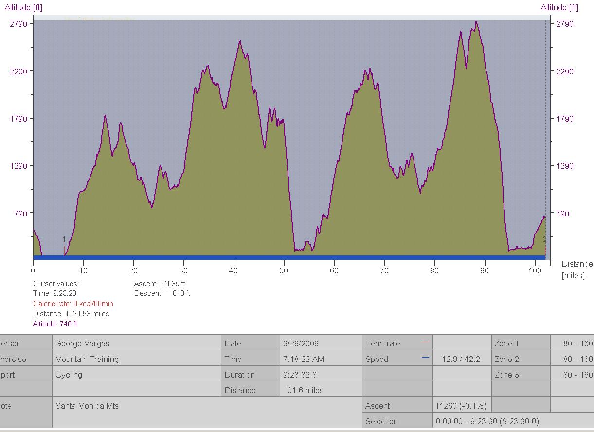
Mileage 92.25 miles with 11,100 feet of gain
The only thing left was the third and final descent on Sunrise Hwy to Pine Valley.  We arrived at Pine Valley, the start/finish point, at 4:20pm.  Just shy of 10 hours on a hard climbing century with plenty of regrouping and picture taking.  The event will have a 12 hour limit.  It is more than doable!!
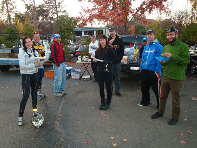
Once at the finish Adobo Velo pulled out all the stops.  They had set up a HOT MEAL!  Can you believe that?  There was Chicken Adobo and a Vegetarian Stew complete with bread and all the other things we had during the day.  It was a cold descent from the summit of Mount Laguna but the hot food at the finish helped me forget about my discomfort.  Thank you again Adobo Velo.   
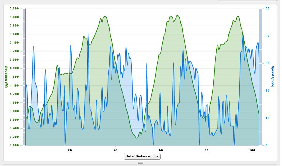
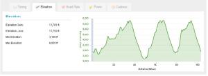
Additonal graphs from my friend’s Garmin.  It calculated 11,700 feet of gain. 
Here’s the great thing about this ride if you are unsure whether you can complete the whole century you can pre-ride portions of it.  Your strategy may be to work on your endurance by doing the different loops on different days.  All the graphs and maps of the route are available online for you to plan your ride.  Try one loop or two and maybe the whole enchilada before April 17th.  I would strongly suggest doing a pre-ride of Loop 3 so Pine Creek doesn’t catch you by surprise.  Your gearing selection will greatly improve your success on the most difficult climb of this event. 

The Mount Laguna Bicycle Classic is going to be a great addition to the century options already offered in San Diego.  It will appeal more to the rider looking for a challenge and likes to climb.  One other great thing about this ride is that the traffic is significantly lower than any of the organized centuries or doubles I have done in Southern California.

It will be a timed a event but not a race.  If you belong to a club AdventureCorps will recognize the top three co-ed members of your club with the best times.  It is a fantastic event with little known and scarcely traveled roads.  There is a rider limit of ONLY 300!  Sign up today!

Here is a slideshow with music from AdventureCorps

Slideshow of the entire route

Extensive route maps and elevation profiles

Mount Laguna Bicycle Classic


The Mount Laguna Bicycle Classic, a new ride offered by AdventureCorps, is coming to the tranquil little town of Pine Valley.  On April 17, 2010 AdventureCorps will provide a new cycling challenge for 300 riders.   The stats for the ride are 103 miles and 10,000 feet of elevation gain.  Registration opened earlier this week but you need to hurry 300 spots will go fast. 

I will be doing a pre-ride of the course next Saturday November 14th.  I will have a full report upon completion of the ride.  I’m really looking forward to climbing Pine Creek Road. I’ve climbed Mount Laguna and many of the roads in the surrounding area many times but somehow I haven’t climbed Pine Creek Rd. 

If you are up to the challenge sign up for the Mount Laguna Bicycle Classic registration has been open since Novemeber 2nd.

Santa Monica Mountains Century


I believe the entire century was done in this area. South of Hwy 101.

11,000 feet of climbing in a 102 miles.

For the power mongrols– over 4,000 kj (I weigh about 155lbs)

I’ve got just a few minutes to spare but I am bursting with excitement about my great training ride on Sunday March 29, 2009.

Chris Kostman, from AdventureCorps, took me for a ride in the Santa Monica Mountains. Home of the famous Mulholland Hwy and many other roads. Luckily Chris knew every road, and fire road, in the area because I was so turned around I didn’t know where I was half the time. He even knew the locations of all the secret “water holes”.

The weather was overcast and hazy and a bit chilly when you hit patches of low fog. The riding was amazing and the climbing was very challenging. But doesn’t that make for a better ride? Of course it does!!

I haven’t had time to download the pictures and videos yet. Check back in a couple of days.

My proposed training ride…


I would like to do Breathless Agony this year because it is a great event, put on by great people. Chuck Bramwell and Santiago Cycling provide outstanding support.

But my schedule is different this year. I will be doing Trans Iowa .

However, I still love the climbing out there and these long flat commuting miles are boring me. So here is my proposed training ride for tomorrow.

If you can believe Bikely.com it “suggests” 13K feet of climbing in a little over 100 miles.


CUE SHEET

MAPS ON BIKELY.COM

Death Valley Double Century


Brandy and I did the Death Valley Double Century on Feb 28, in a sub 15 hour time. It was much tougher than I remember it when riding it solo. The climbing was much tougher on the tandem. It marks my 19th Double Century.

I love riding in Death Valley. The scenery is spectacular. We were fortunate to have a very mild day. It was slightly overcast and I don’t think the mercury rose above 85F.

Brandy was a real trooper as she suffered from undercarriage issues. We both suffered from nausea but that expected at least once in a 200 mile event.

Chris Kostman puts on a fantastic event. It is very well supported. The aid stations are all in the right place. Thanks to Hammer Nutrition we felt well fueled all day.

If you haven’t ridden in Death Valley you have to put it on your short list of rides to do. AdventureCorps is offering yet another opportunity to ride in Death Valley on April 18th. It is a century ride with other activities. It is called the Hell’s Gate Hundred. There will also be a Fall Double Century and if you are an Ultra Cyclist you should try and tackle the Furnace Creek 508!

I haven’t done a slide show for the Death Valley Double Century. But here are a few pics from the weekend.

On the drive in to Death Valley we took Chris Kostman’s suggested a more adventurous route up through Emigrant Pass. It was a very good suggestion and we thoroughly enjoyed the “off the beaten path” directions. I longed to get on my bike as we climbed up to Emigrant Pass.

The morning of the double century.

The highest point of the event don’t forget to add the an additional 282 feet– the amount of feet we were BELOW sea level at Badwater.

On the drive home we took a different route and took Townes Pass out of Death Valley.

Ever wonder why the climb up Townes Pass hurts so much on the 508? Well this sign tells quite a story doesn’t it?