


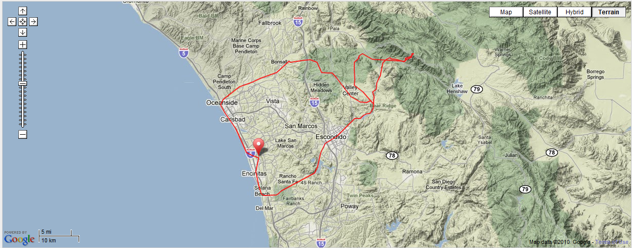
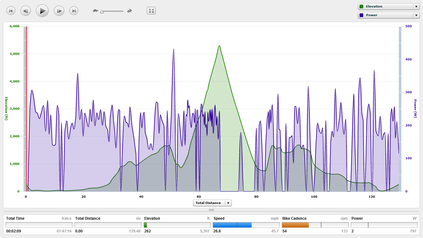
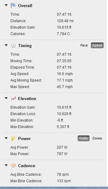
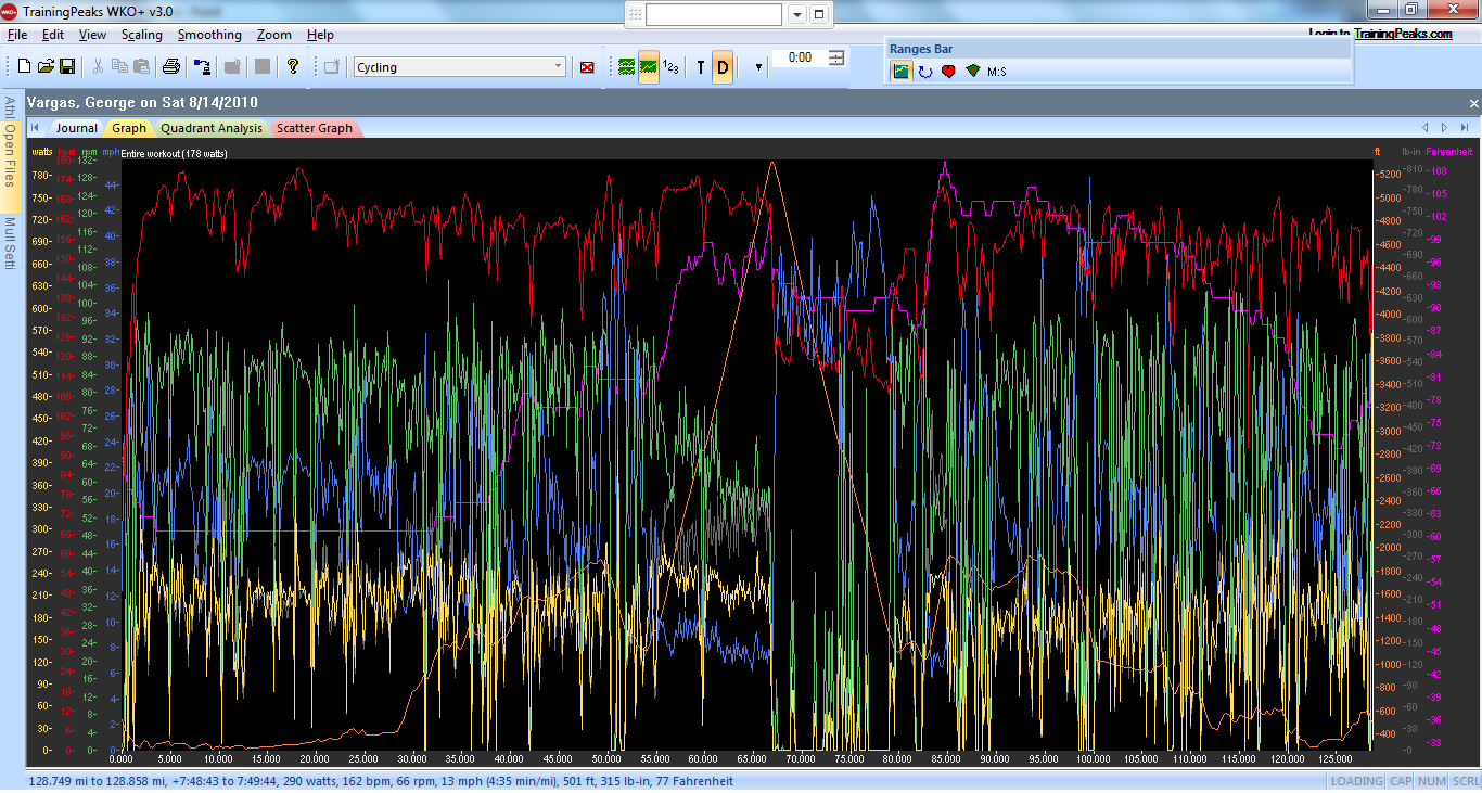
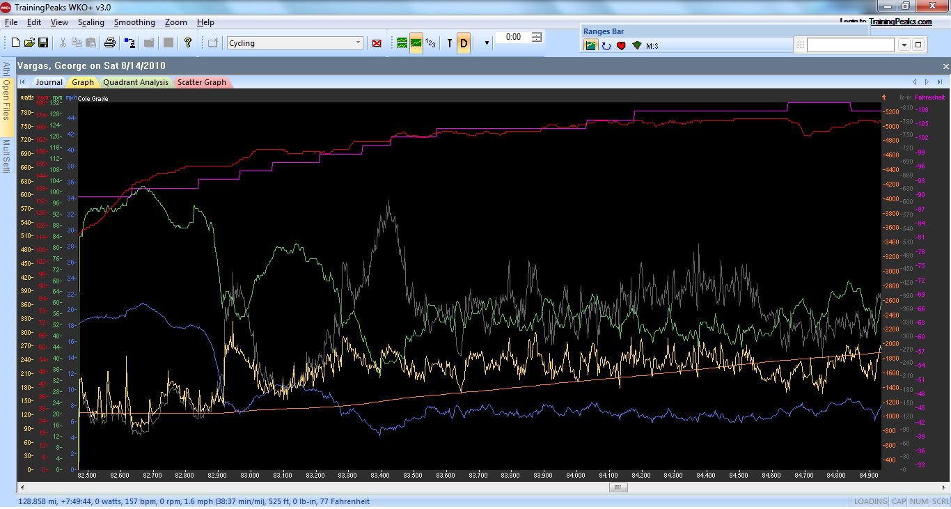
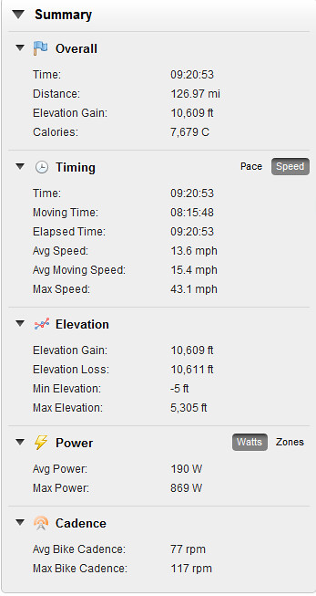
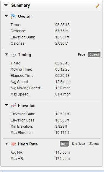
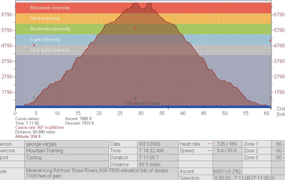
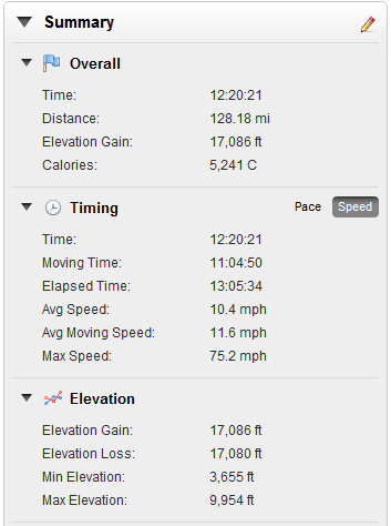
128 miles with 17,000 feet of climbing

5400 kjs – a good days work
UPDATE: THE TEN TOUGHEST CLIMBS CONTINUED…
More pictures on my Flickr
CLICK HERE IS THE GARMIN PLAYER FOR THE RIDE
CLICK HERE FOR RIDE WITH GPS PLAYER
I came across the list below, California’s 10 toughest climbs, on Wednesday 6/09/10. I can’t remember what I was Googling at the time. But when I saw this list it really intrigued me. I thought wow this looks like a great “to-do” list to work off of. I asked a few friends for advice and planned a quick trip within a couple of hours.
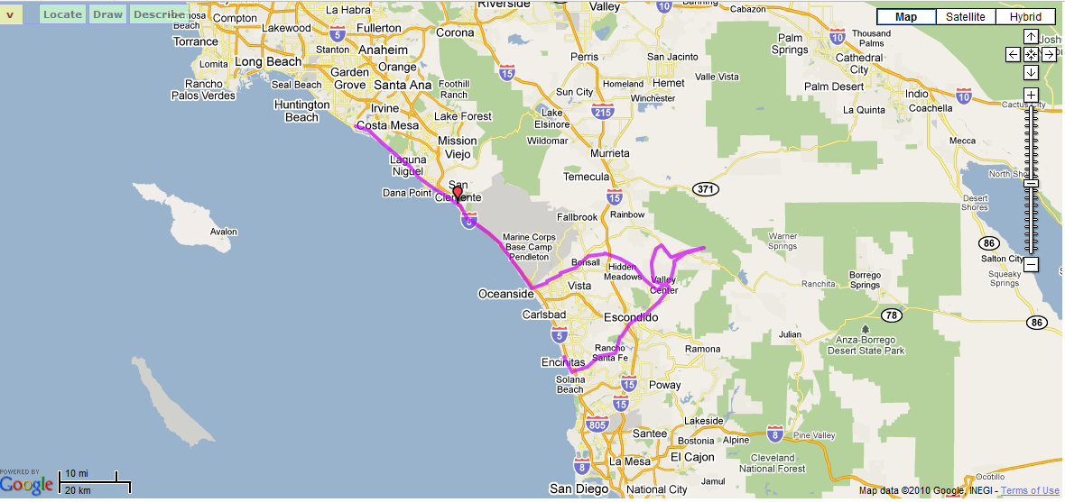
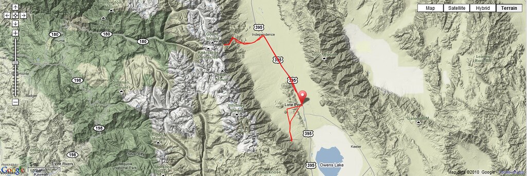
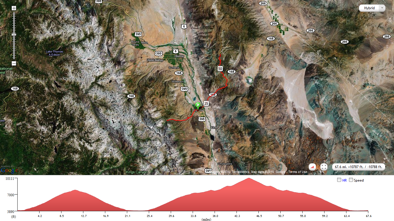
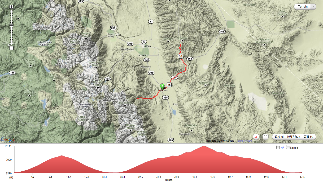
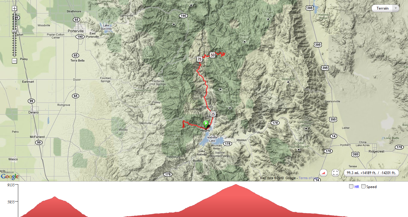
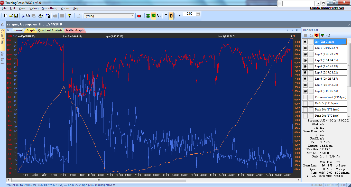
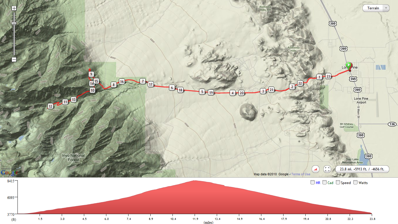
After consulting a map I found that quite a few climbs were concentrated in the Eastern Sierras. I also noticed that three climbs were in close proximity to each other. I got this crazy idea that I could do something REALLY Epic and do three of the climbs, Onion Valley, Horseshoe Meadows and Whitney Portal all from a “base camp” in Lone Pine. The ride turned out to be 128 miles with 17,000 feet of vertical gain. Subtract the 34 junk miles from Lone Pine to Independence and back and the final 11 mile descent off of the Whitney Portal and you have a 17,000 feet of climbing in 83 miles — far less than a century!! I personally don’t know anyone who has done all three climbs in one day!!
In his book, The Complete Guide to Climbing (by Bike) in California, John Summerson gives a great overview of the 100 hardest climbs in California.
He developed his own rating method, which is similar to the method used on this website, with additional adjustments for altitude, grade variability, and road surface.
Most Difficult Climbs:
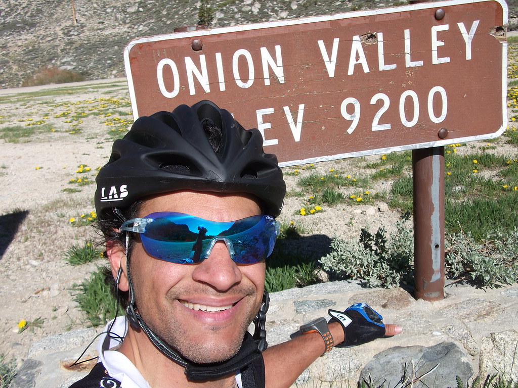
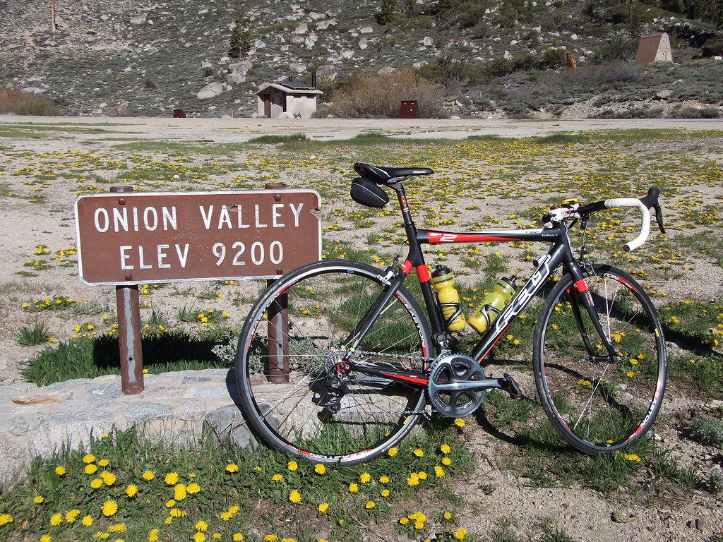
1) Onion Valley — DONE 6/10/10 !!
2) Horseshoe Meadows — DONE 6/10/10!!
3) White Mountain
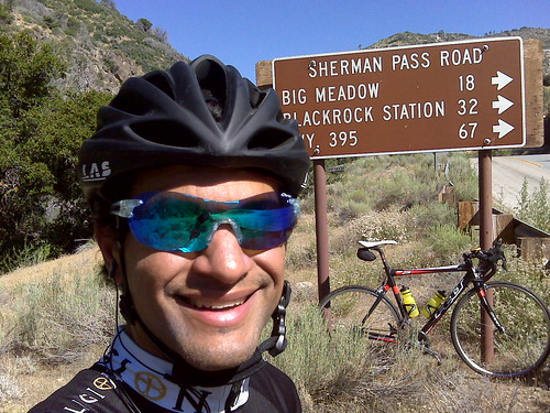
4) Sherman Pass
5) Whitney Portal — DONE 6/10/10!!
6) Mount Baldy
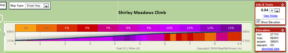
7) Shirley Meadows
8) South Lake
9) Mount Palomar DONE 6/06/10!!
10) Mosquito Flat
Greatest Elevation Gained:
1) Horseshoe Meadows – 6,234 feet– DONE 6/10/10 !!
2) White Mountain – 6,204 feet
3) 190 – 6,199 feet
4) J21/245/180 – 5,750 feet
5) Mosquito Flat – 5,548 feet
6) Dantes View – 5,475 feet
7) South Lake – 5,445 feet
8) Sherman Pass – 5,316 feet
9) Emigrant Pass – 5,309 feet
10) Onion Valley – 5,169 feet DONE 6/10/10!!
Highest Elevation Attained:
1) Mosquito Flat – 10,220 feet
2) White Mountain – 10,152 feet
3) Horseshoe Meadows – 10,034 feet DONE 6/10/10!!
4) Tioga Pass – 9,945 feet DONE 7/27/12!!
5) South Lake – 9,852 feet
6) Sonora Pass – 9,624 feet DONE 7/6/13!
7) Kaiser Pass – 9,184 feet
8) Onion Valley – 9,163 feet — DONE 6/10/10!!
9) Lake Sabrina – 9,141 feet
10) Sherman Pass – 9,126 feet
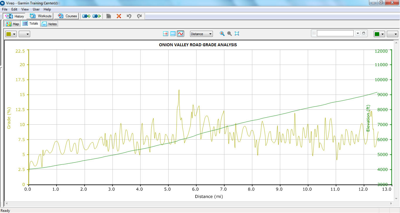
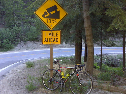
1) Onion Valley (5,169 7.8% 12.5 miles)
2) Horseshoe Meadows — (6,234 feet 6.2% 19 miles)
3) White Mountain (6,158 feet 5.8% 20.1 miles)
4) Sherman Pass (5,316 6.6% 15.2 miles)
5) Whitney Portal — (4,580 feet 7.7% 11.3 miles)
6) Mount Baldy – (4,830 feet 7.1% 12.9 miles)
7) Shirley Meadows (4,105 feet 7.9% 9.9 miles)
8) South Lake (5,445 feet 5.5% 18.8 miles)
9) Mount Palomar (4,731 feet 6.8% 13.2 miles)
10) Mosquito Flat (5,548 ft 5.1% 20.5 miles)
source
Additionally, here is the list of the 10 toughest climbs in the US.
Below is a list of some of the top cycling climb bike rides that are listed in the book Best Cycling Climbs In The US . The book lists the 100 toughest USA road bike climbs from 1 to 100.
- Mt Washington, NH
- Haleakala, HI
- Onion Valley, CA
- Horseshoe Meadows, CA
- Mt. Equinox, VT
- White MTN, CA
- Mt. Baldy, CA
- Mt Graham, AZ
- Mt. Lemmon, AZ
- Palomar Mountain, CA
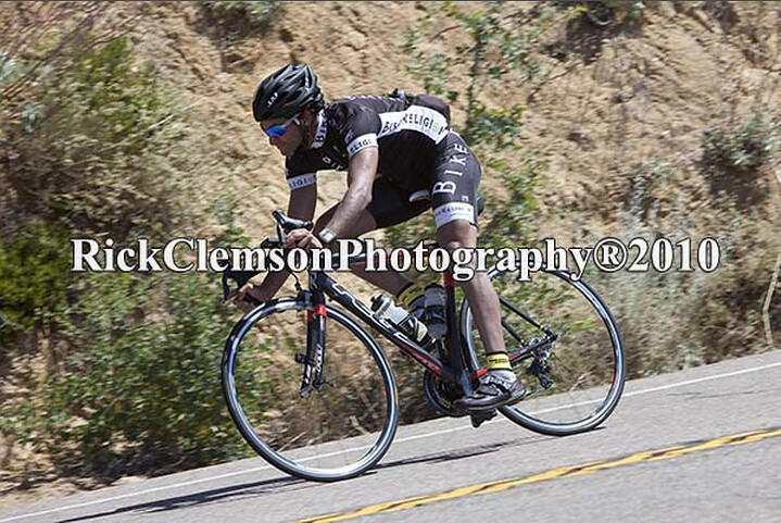
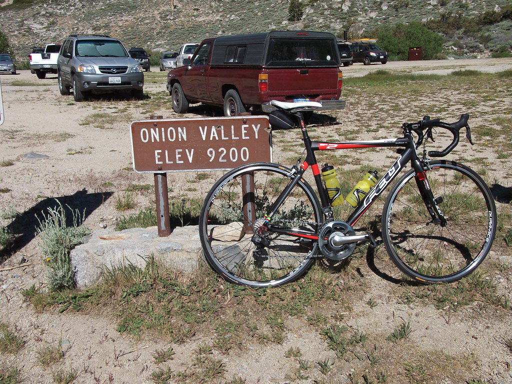
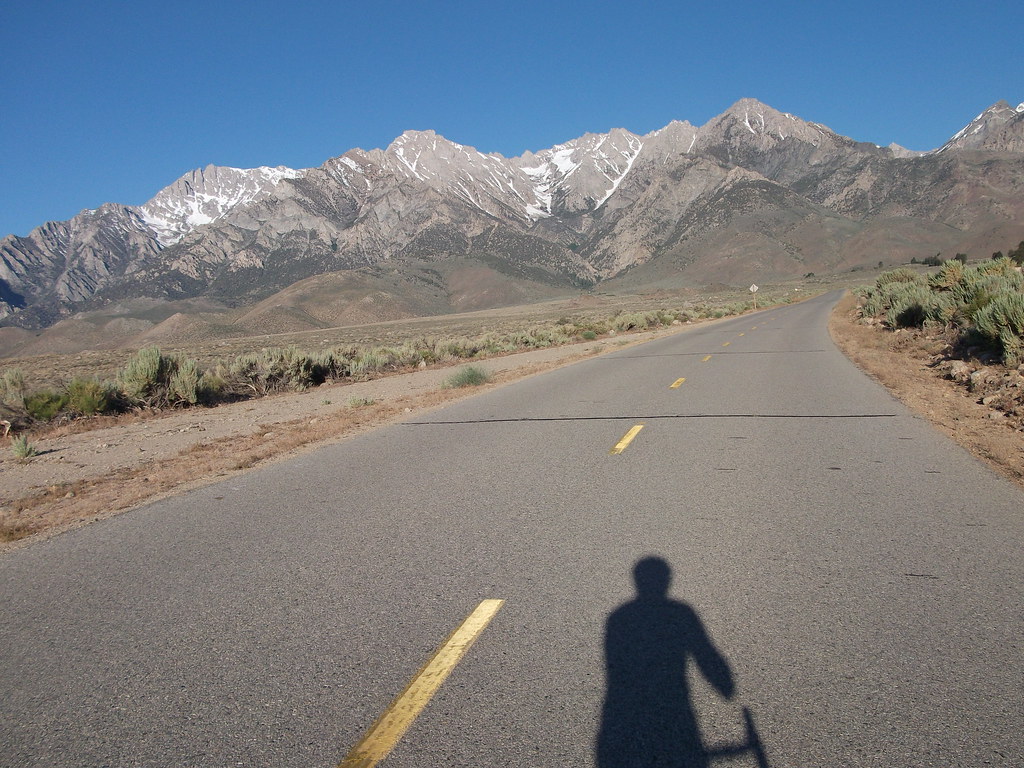
ONION VALLEY

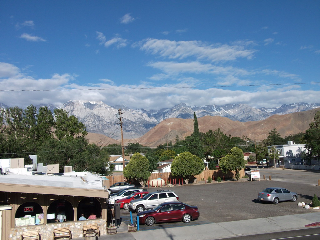
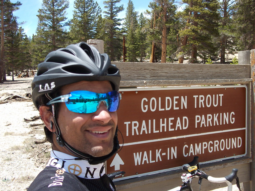
After work, I drove from Newport Beach to Lone Pine. I made a stop along the way to purchase a small point and shoot camera. I thought it was important to share my adventure properly. I hope you enjoy the pictures.
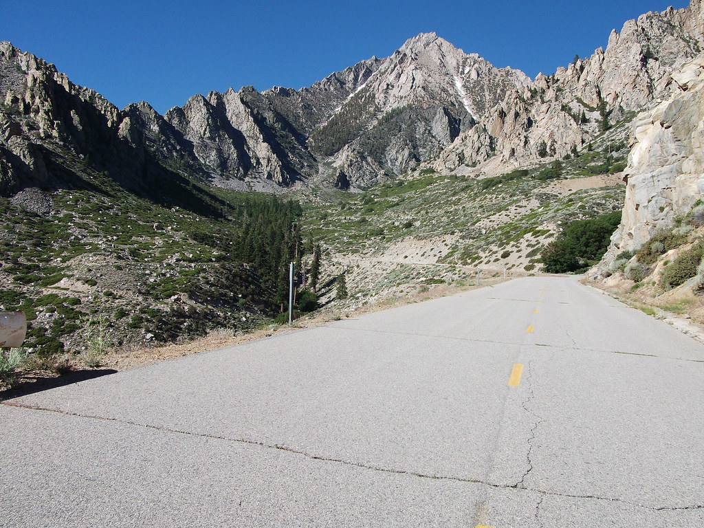
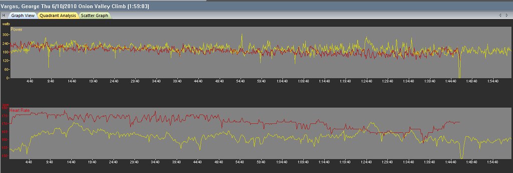
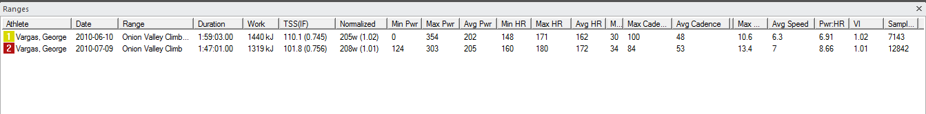
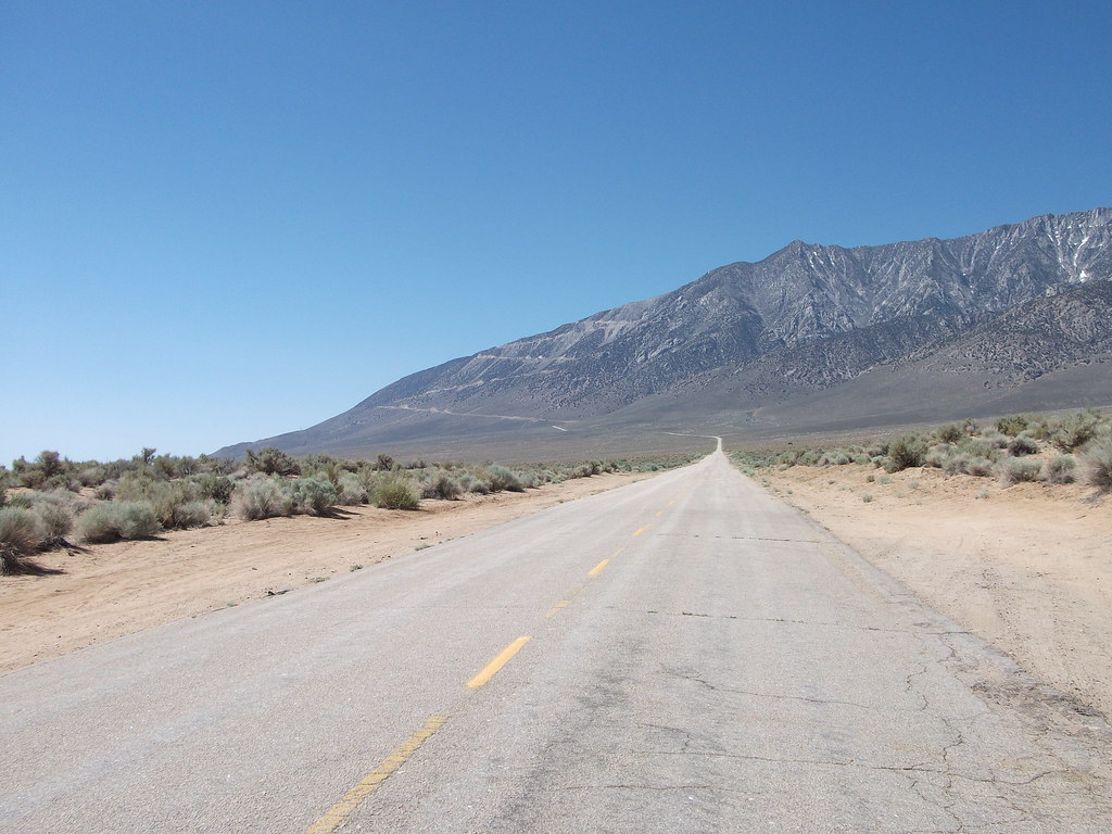
I arrived late in the evening. I stayed at the Whitney Portal Hostel (760) 876-0030. A nice clean and inexpensive place and I highly recommend it. On Thursday morning, I rolled out at at 5:30am. I rode the 16 miles to Independence for the first climb of the day — ONION VALLEY ROAD. My reasoning was if ONION VALLEY ROAD was considered the toughest climb in California it would be prudent to tackle it first, while the legs were fresh.


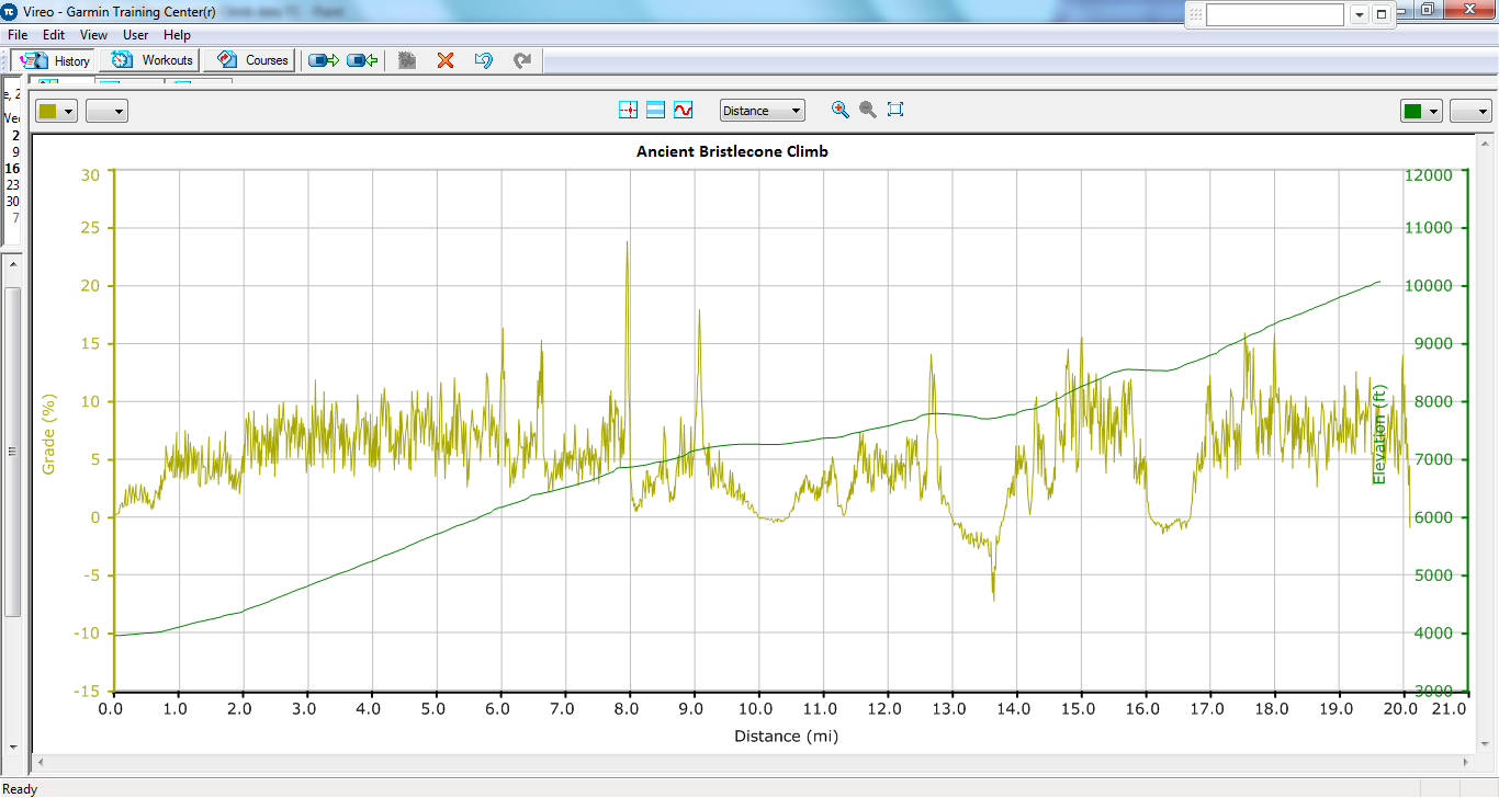
It can not be overstated, Onion Valley is one tough climb. Man when it ramps up and then stays at 8-9% for sustained sections– better said– miles and miles it really takes ganas to summit Onion Valley Road. I was riding Felicia – my 2010 Felt F2 with Di2. A fantastic riding bike and now I was putting her through a climbing camp. I had a standard 53/39 and an 11/23 cassette. I probably should have had at least an 11-25 cassette. Later in the day I would regret the 11/23. As I mentioned before, I left straight from work and didn’t want to stop by the house. This was a spontaneous trip. I had my bike with me and a couple of cycling kits in my “race bag”. I figured I would buy what I needed along the way. Unfortunately, I wasn’t prepared for the steep grades dished out by Onion Valley Road. I had been riding mostly flatter training rides in the Orange County area hence my cassette was an only an 11-23.
I really enjoyed the climb even with all the steep grades. It was early in the morning and there were no cars on the road. I actually can’t remember seeing a car for the full 26 mile round trip up and down Onion Valley Road.

Nice Smith Pivlock 90’s- Thank you Smith Optics

Felicia- My Felt F2 with Di2 which performed FLAWLESSLY!!
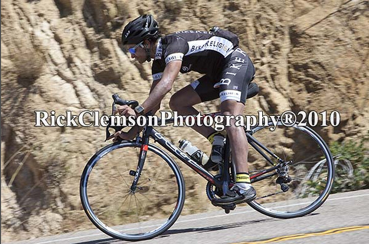
The descent was very sketchy. The winds were swirling on the climb up, which was manageable at slower speeds. But on the descent, I would get up to 50 mph and bank into the corner and BAM! get hit with a massive gust of wind and be blown off my line completely. After three of these scared poopless moments I decided to slow down and take the corners more conservatively. The winds were so unpredictable and so strong I was surprised that even with my low profile training wheels that I was getting tossed around so much. When I reached the straighter sections of the descent I let her fly.


Below is another description I found on the internet about Onion Valley Rd
10 Miles
Onion Valley Rd.
Mile 2.5-12.5, Independence, California–8.3%
The last 10 miles of this 12.5-mile ascent are the steepest stretch of that length in the country–and also higher than 5,000 feet, a combination that unquestionably makes it the most difficult. The first 2.5 miles are a great warm-up. Like most Eastern Sierra climbs, the road sneakily gets steeper as you ascend, then the switchbacks begin and you’re in no-man’s land: too far up to see the start, too far down to see the finish. After you clear the Sierra foothills, the twisting road eases its slope then kicks into an alpine climb along a narrow road between soaring rock walls, with the massive Owens Valley visible behind you. You hear but cannot see a rushing creek. Close to the top, an elegant S-curve funnels you into an alpine bowl, then the climb ends soon after. Longer than Alpe d’Huez and steeper than the Galibier and Tourmalet, the last 10 miles of Onion Valley are legendary. Get There: From Independence, turn west on Market Street. The road becomes Onion Valley Road; the climb starts at the cattle guard.
source
HORSESHOE MEADOWS

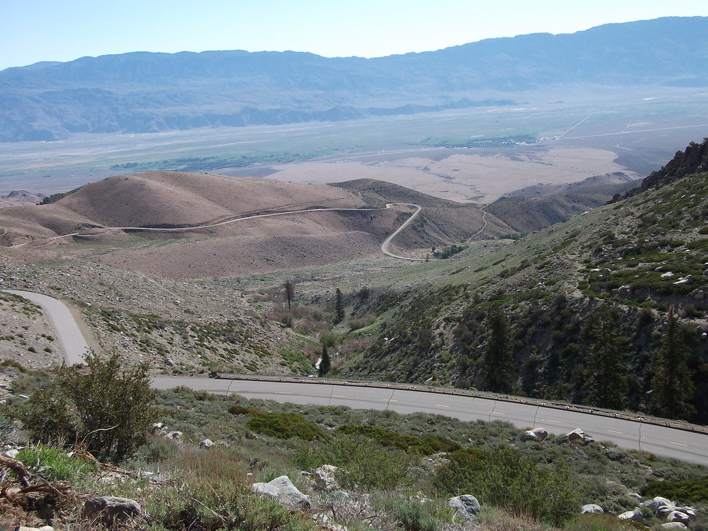
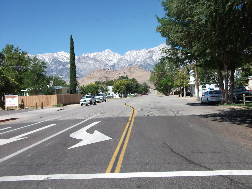
After my descent of Onion Valley Road I had to ride the 16 miles back to Lone Pine. It was generally downhill and I had a slight tailwind. I refueled at my “base camp” Whitney Portal Hostel. I then headed up for my second major climb of the day. The second toughest climb in California — HORSESHOE MEADOWS.
 There is one thing I should mention about my return leg to Lone Pine. The 395 is under construction. There was only one lane in certain sections. I had to take the lane and I think some motorists were upset but there was no shoulder as you can see from the photo above. As I stated before it was generally downhill 1% grade and a little tailwind. So I Time Trialed the sections with no shoulder above 300 watts going 30 +mph. 😀

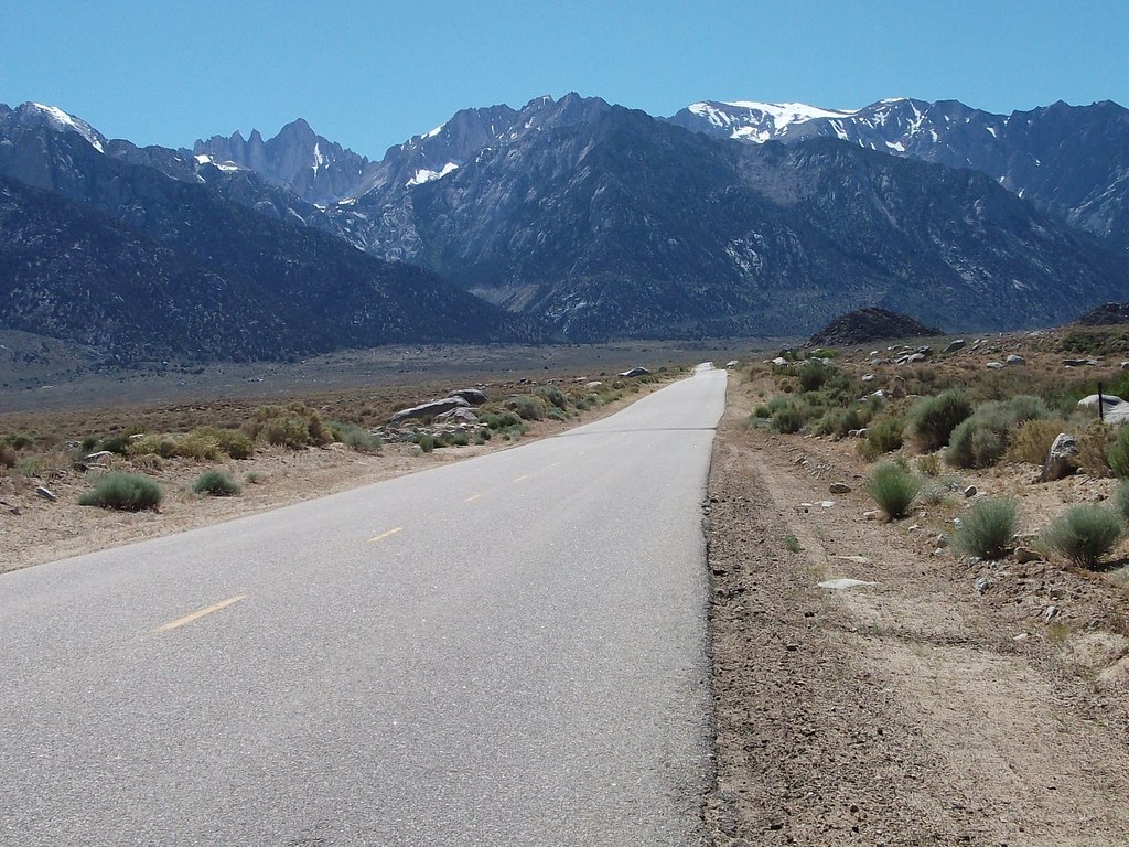
Three miles into the Whitney Portal climb you see the turn off for Horseshoe Meadows
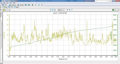
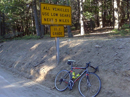
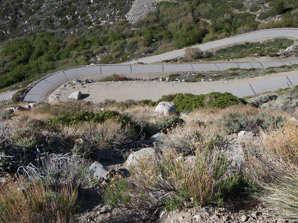
Ok back to the Horseshoe Meadows climb -this is one beast of a climb. 20+ miles and over 6,000 feet of gain!! And it’s not just the vertical gain, but the grade just kicks up and is unrelenting. When you first see the switchbacks they are awe inspiring. They are so far off in the distance and yet they still look massive. See below.

The HORSESHOE MEADOWS climb was difficult because there weren’t any signs telling me what was up ahead. Even when there was a sign it didn’t state the mileage to the campgrounds or to the summit. I am a data geek and sometimes that can be my downfall. I like to know the stats of a climb and keep them in mind as I ascend. I like to know, for example, 10 mile climb 3,000 feet of gain. My Furnace Creek 508 crews have always been made well aware of my need for climb data– ACCURATE climb data. All three of the climbs I did yesterday were new to me. And while that was part of the allure it was also different for me to not know what to expect.

Much needed shade tree
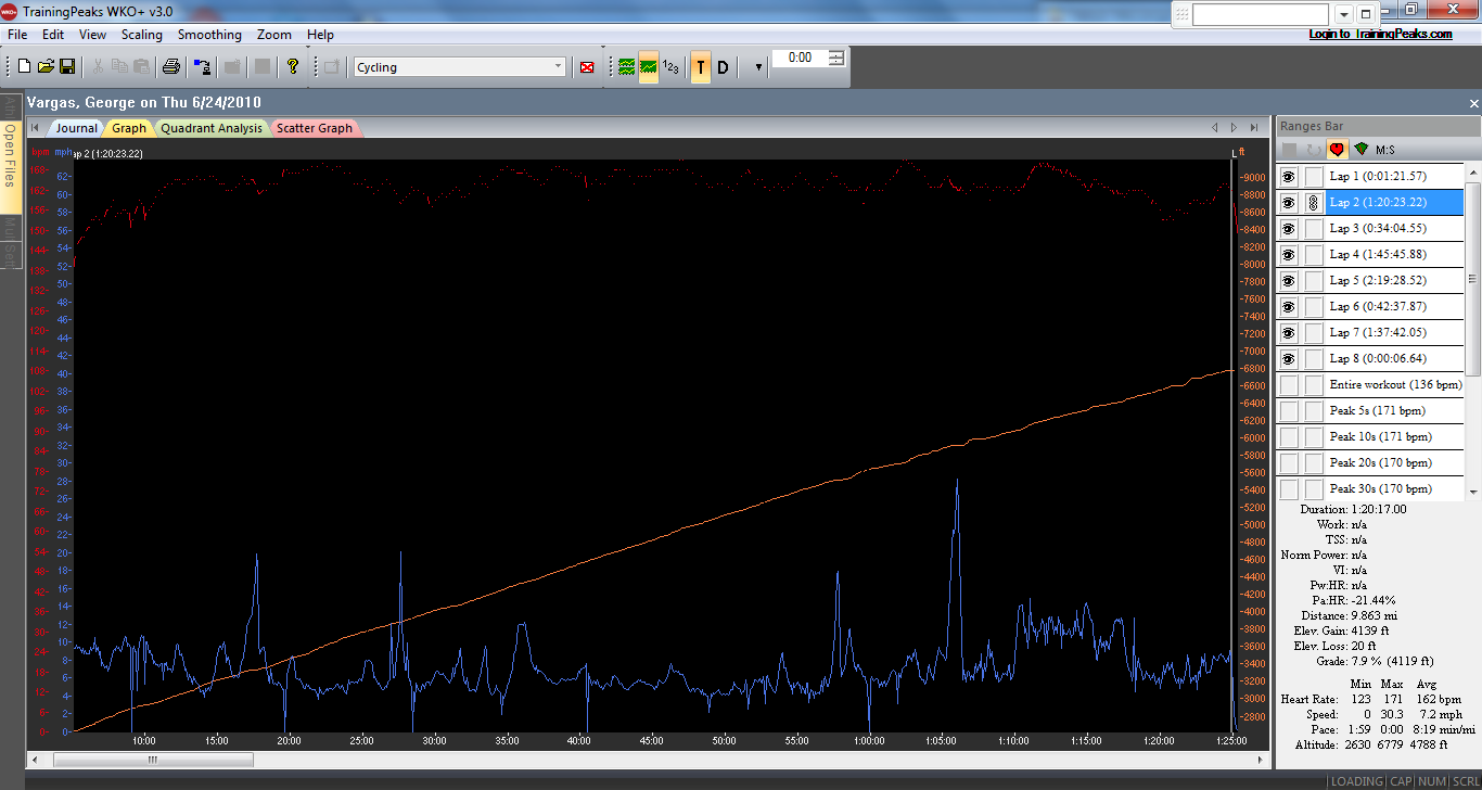
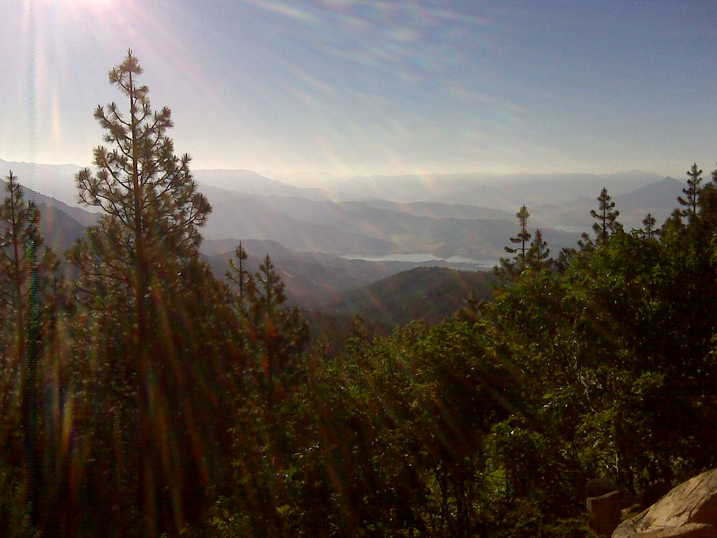
Half way up the mountain, the perfect climbing weather I had enjoyed earlier in the day was turning out to be a scorcher– over 95F! I was only carrying three bottles– two on the bike and one in my jersey pocket. I was conserving my fluids for the 20+ mile climb. Now a little insight into the way my mind works– I’m too hard on myself and I always think a climb should be done in one shot– that means no stopping. And that rule applies whether it’s 2 miles or 22 miles. But I was starting to feel the cumulative effects of being on the second major climb and only having had 4 bottles in the last three hours. I pulled over and took 5 minutes to cool down. The shade felt great and although I wanted and needed to stay longer I had to keep moving. There is always this little voice that says “GET BACK ON THE BIKE!” When I reached the summit I couldn’t find an elevation sign so here is what I have for proof that I was there 😉 You have to be prepared to be on a climb for at least 2 hours (if you can climb at 10 mph which most of us can’t) and then descend at least another 30 minutes with fluids and/or solid fuels for a round trip of at least 2.5 – 3 hours of very intense climbing and descending in the heat of June!

ELEVATION 10,000 FEET!

HORSESHOE MEADOWS, the second toughest climb in California, done!! I front flatted on a sharp corner going about 30 mph. I kept the bike under control and came to a stop. Whew!! I then descended the rest of the way back to the Whitney Portal Hostel to refuel.
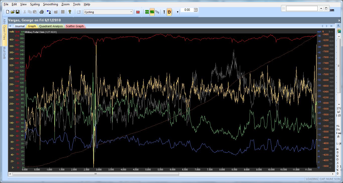
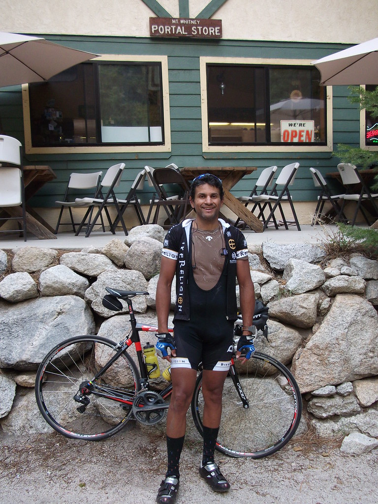
WHITNEY PORTAL

A description of the Whitney Portal-
Stage 10 (Monday July 14) Pau – Hautacam 154 km
After L’Alpe d’Huez the Col du Toumalet may be cycling’s most famous climb and the big test of stage 10. California’s Whitney Portal is very similar although perhaps even a bit more difficult and spectacular; a rarity in the world of mountain cycling.
Whitney Portal
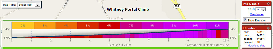
Total elevation – 4,580 ft Length – 11.3 miles
Average Grade – 7.7% (13%) Rating – 3.98 (hors)
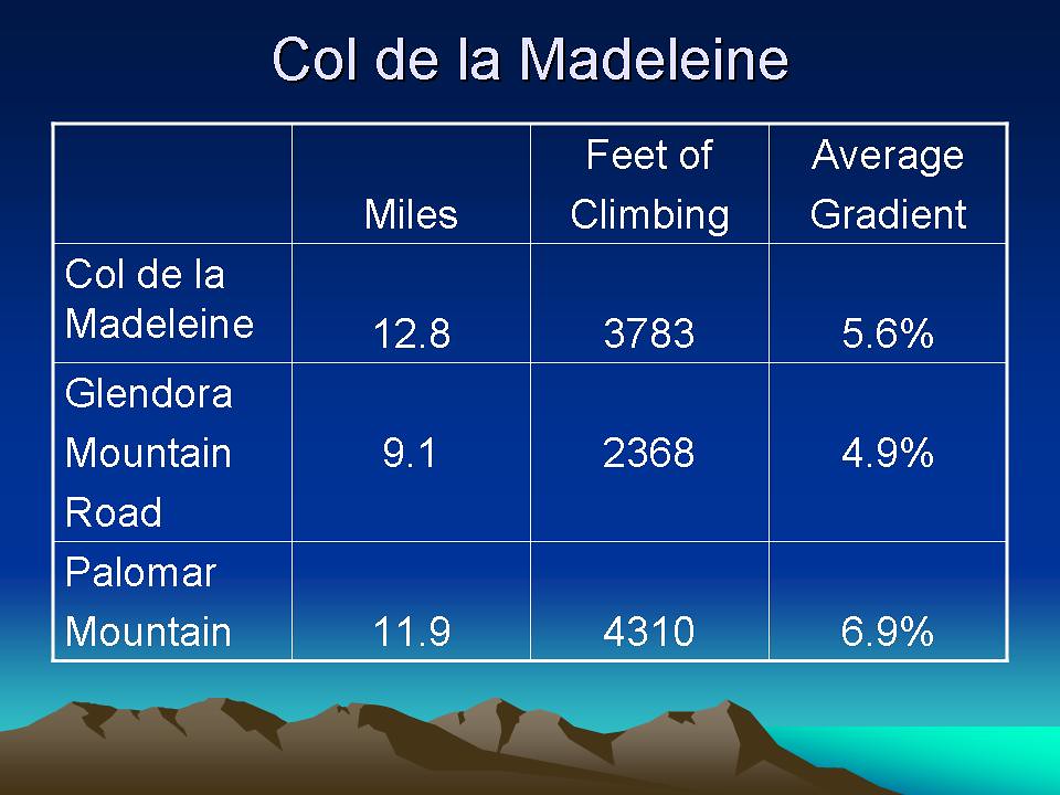
 Whitney Portal is a great and difficult climb out of the high desert up towards Mount Whitney, the highest mountain in the lower 48. Like most eastern Sierra ascents this one starts out tame and ends up tough. The grade generally increases as you climb so that a five mile stretch in the 2nd half averages 9%. The hill lets up just before the finish at Whitney Portal and a parking/hiking area (trailhead to Mt. Whitney). Whitney Portal is also very similar to the famed French climb of the Madeleine, a monster frequently used in major cycling classics including regular appearances in the Tour de France
(closed in winter – Inyo National Forest – 760 876-6222).
source

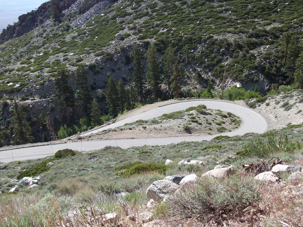
My last climb of the day was Whitney Portal. I began the climb about 3pm. Needless to say it was the hottest part of the day. I could’ve and should’ve spent more time in the air conditioning of the Whitney Portal Hostel. It would have helped get my core temperature down before starting the third major climb of the day. But I was determined to get out there and get it done. According to John Summerson’s book, Whitney Portal is the 5th Toughest Climb in California.
I really struggled on this climb. The 53/39 and 11/23 cassette were now a detriment to me getting up the “hill”. Whitney Portal is really steep for the last 5.5 miles, averaging 9% grade. I had to pull over four times finding small bushes and trying to put my head in the meager shade provided by them. There weren’t any trees on the Whitney Portal climb until the higher elevations. As a matter of fact, all three of the climbs were very exposed. There isn’t shade anywhere to be found.
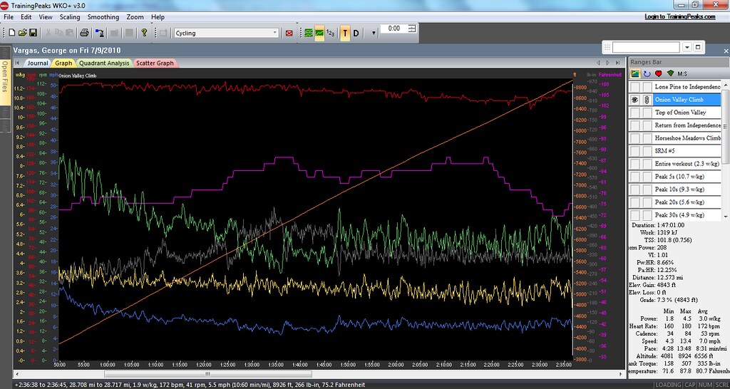
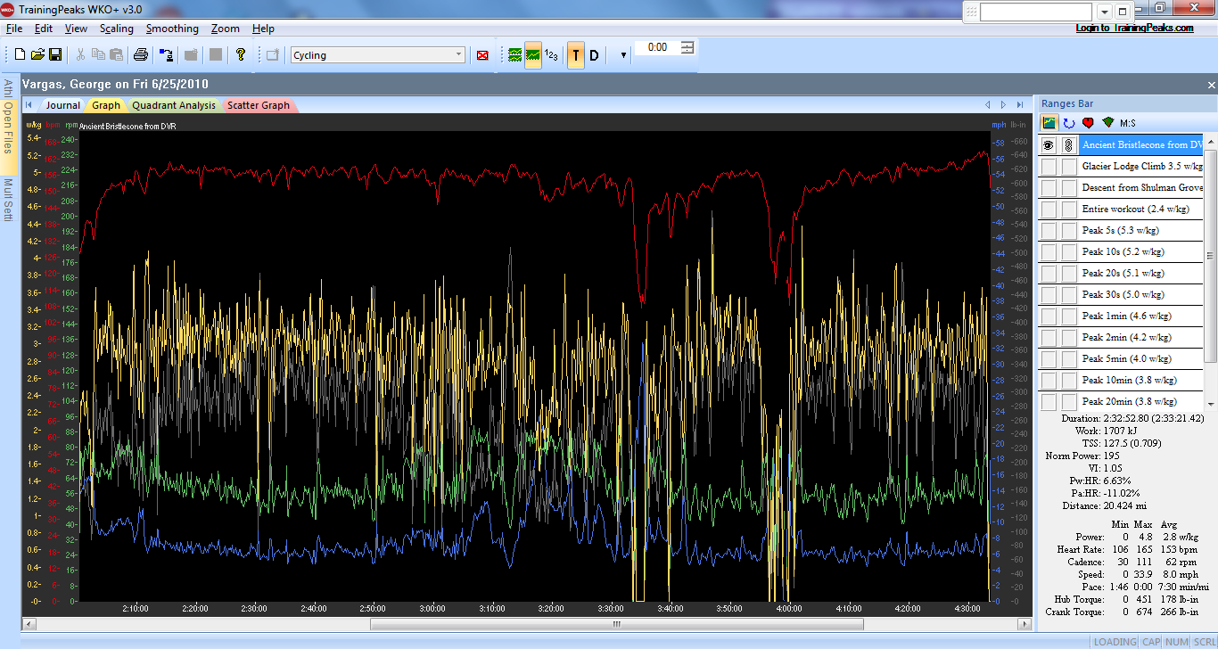
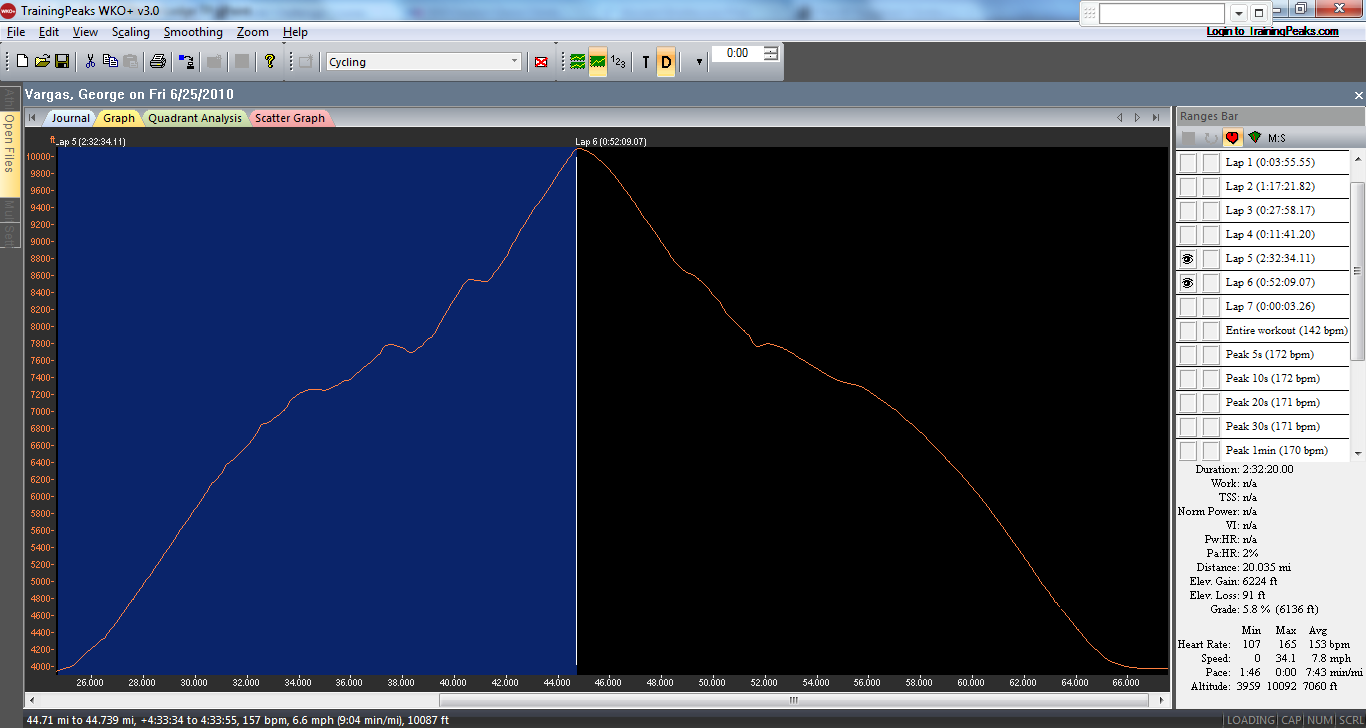
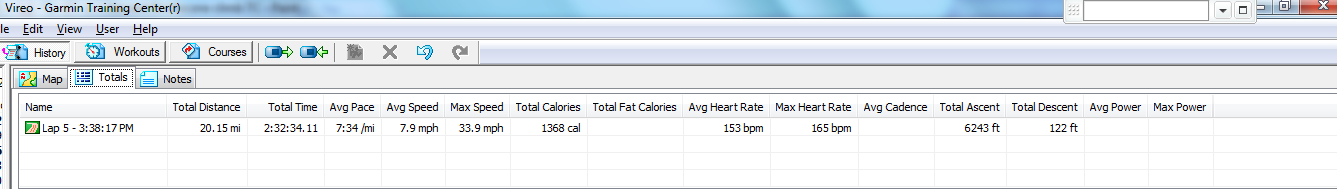
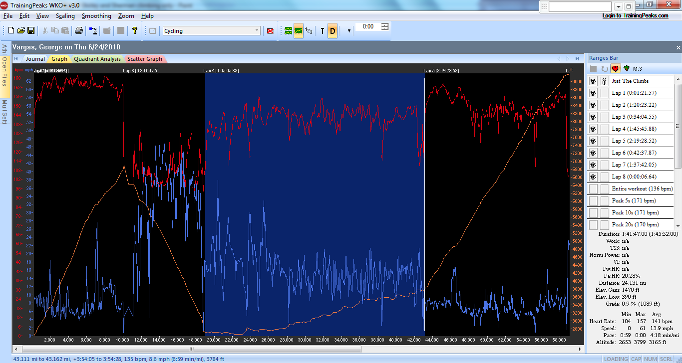
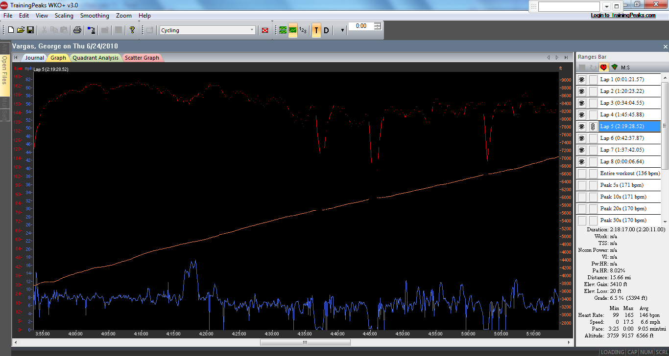
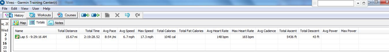
After suffering on the lower slopes I got onto the switchbacks was now in the shade. On the lower slopes I was heading straight into the sun. But on the switchbacks the mountain was blocking the sun and providing much needed shade. My legs were wrecked, the fatigue of the 15,000 feet of gain so far, was making itself very apparent that maintaining even 5 mph was a struggle. I made it to the top but it wasn’t pretty nor was I as swift as I had hoped but I “got ‘er done”! I looked at my Garmin 310XT –17,000 feet of gain for the day wow!!

Look for the switchbacks on Whitney


Tackling all three of these massive climbs in one day was my goal because of the close proximity of two of them to each other – Whitney Portal and Horseshoe Meadows. But honestly, it was a bit too much. It was a huge psychological battle to complete my final climb of Whitney Portal. It was hot, my legs were shot and I was nauseous. I think I was affected by the altitude on the Horseshoe Meadows climb. Additionally, I know I was beyond behind on calories and hydration. It’s just too hot to be unsupported for that long.
What I wasn’t given in genetics for climbing ability I was given in just plain stubbornness. I can tolerate an awful lot of pain and I strongly believe that I can tolerate more pain than the next guy. I also know my body pretty well. After seven years of Ultras and training for them I have learned how far I can push my body, in particular because I train alone. I know just the precise time to take that “5 minutes” off the bike so that I can continue without the infamous meltdown. When attempting this ride you should know that aside from refueling at Lone Pine there isn’t anywhere else to refuel. I’m glad I did the three climbs but I don’t think I will be doing the three climbs in one day again…well at least anytime soon.
I like the order in which I did the climbs- Onion Valley then Horseshoe Meadows and Whitney Portal last. For me knowing that I was saving the “shortest climb” for last was comforting. You know your perspective is skewed when you think an 11 mile climb is short 😉 You rationalize things like this “Ok all I have to do is get to the top of this (Horseshoe Meadows) and then descend and do the short climb up to Whitney Portal.” When climbing a 20+ mile climb an 11 mile climb IS shorter! But sometimes shorter doesn’t mean easier and shorter many times means STEEPER!
My recommendation for something epic enough would be to do Horseshoe Meadows and Whitney Portal in one day! The grades are so steep and they go on for sustained sections that you don’t need to throw in the third climb. But if you do want a “three bagger” then do the Onion Valley Road climb first like I did. If you don’t mind driving the out and back, you could use that time to recover and refuel instead of riding that section and adding to the cumulative effect that comes from riding an extra 34 miles. But if you’re like me getting in a car in the middle of a ride is ludicrous.
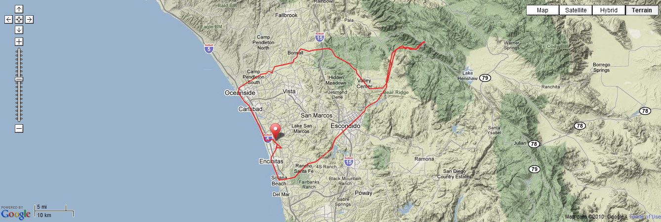
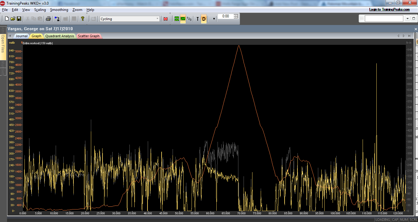
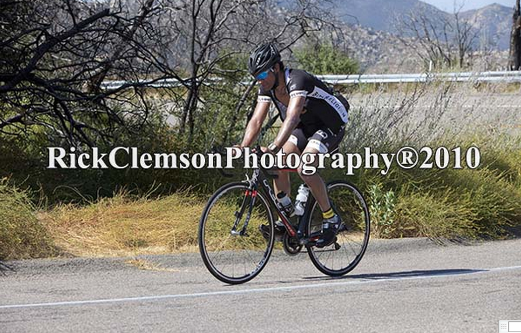
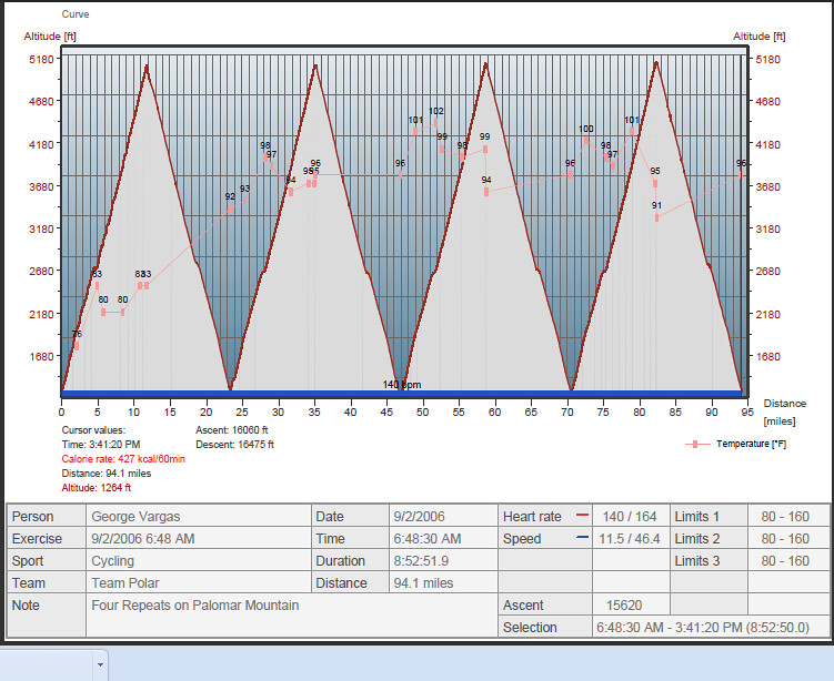
As far as the other climbs on the list, many of them I have done numerous times. For example, Mount Palomar used to be a weekly training ride for me and here is a blog entry from last Sunday. I have also done four repeats on Palomar Mountain in one day see below. So actually within the last five days I have done four of the toughest climbs in California 😉

Number 3 on the list, White Mountain, is part of the Everest Challenge, a race I have completed on two separate occasions. Actually, Everest Challenge helps take care of a couple more climbs on Mr Sommerson’s list of the 10 toughest climbs in California. As part of Everest Challenge, I have also completed Number 8 South Lake and Number 10 Mosquito Flat.
At Number 6, Mount Baldy, is a local favorite and I have been known to do repeats on that mountain as well. The last four miles to the ski lifts are very steep at over 10% average.
The only two climbs left to complete Mr Sommerson’s list are Sherman Pass and Shirley Meadows. Sherman Pass I had heard of but Shirley Meadows was a surprise. I hadn’t heard of it but there are so many great climbs in California how can one person know them all? I will make another trip out here and the list will be complete.
I now have a challenge for you. Why not make 2010 the year you complete the 10 toughest climbs in California? I will call it the “10 in 10 Challenge”. Bookmark this post and as you complete your 10 ascents, or some portion of it, and comment on my blog. I want to motivate YOU to do something EPIC this year!
I have to thank INFINIT NUTRITION for keeping me fueled during this ride. Please give them a try — customize your nutrition based on your race or training needs. When you do use discount code “vireo” and receive 10% off your order!!
All for now and thank you for reading my blog.
UPDATE: THE TEN TOUGHEST CLIMBS CONTINUED…


